IMAGE
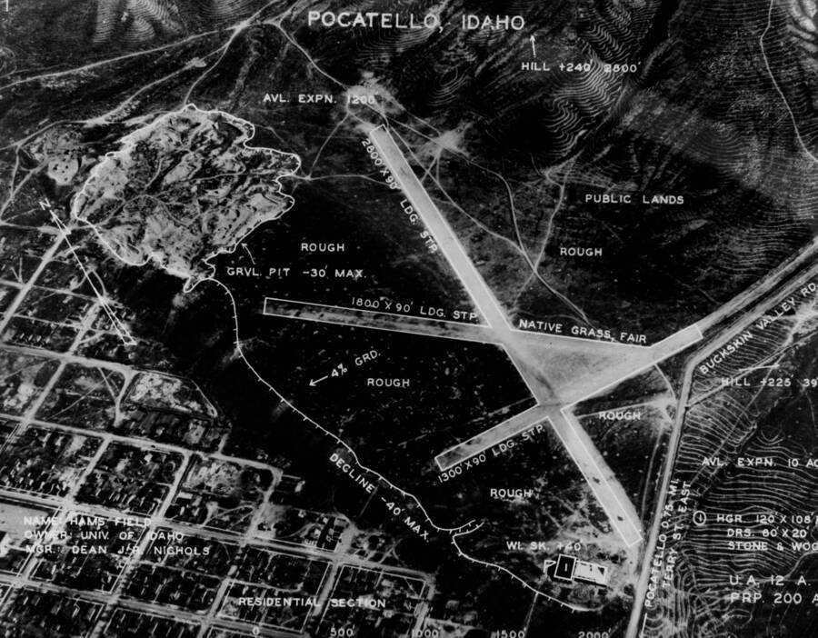
Aerial survey of Ham's Field also known as University Airport Item Info
- Title:
- Aerial survey of Ham's Field also known as University Airport
- Date Created (ISO Standard):
- 1939
- Description:
- Aerial image and survey of Ham's Field also known as University Airport in Pocatello, Idaho. Idaho State University occupied the site currently.
- Subjects:
- airport air strip landing field runway city aerial survey
- Location:
- Pocatello, Idaho
- Idaho County:
- Bannock County
- Latitude:
- 42.868142
- Longitude:
- -112.428839
- Source Identifier:
- NARA10StlPht10
- Type:
- image;stillimage
- Format:
- image/jpeg
- Language:
- eng
Source
- Preferred Citation:
- "Aerial survey of Ham's Field also known as University Airport", Archival Idaho Photograph Collection, University of Idaho Library Digital Collections, https://www.lib.uidaho.edu/digital/archivalidaho/items/archivalidaho262.html
Rights
- Rights:
- In Copyright - Educational Use Permitted. Please note these materials are not held by University of Idaho Library Special Collections and Archives. For more information, please contact the institution listed in the Source.
- Standardized Rights:
- http://rightsstatements.org/vocab/InC-EDU/1.0/

