
IMAGE
Lakes and mountains around South for of Payette River Item Info
- Title:
- Lakes and mountains around South for of Payette River
- Photographer:
- Stevens, A.W.
- Date Created (ISO Standard):
- 1925
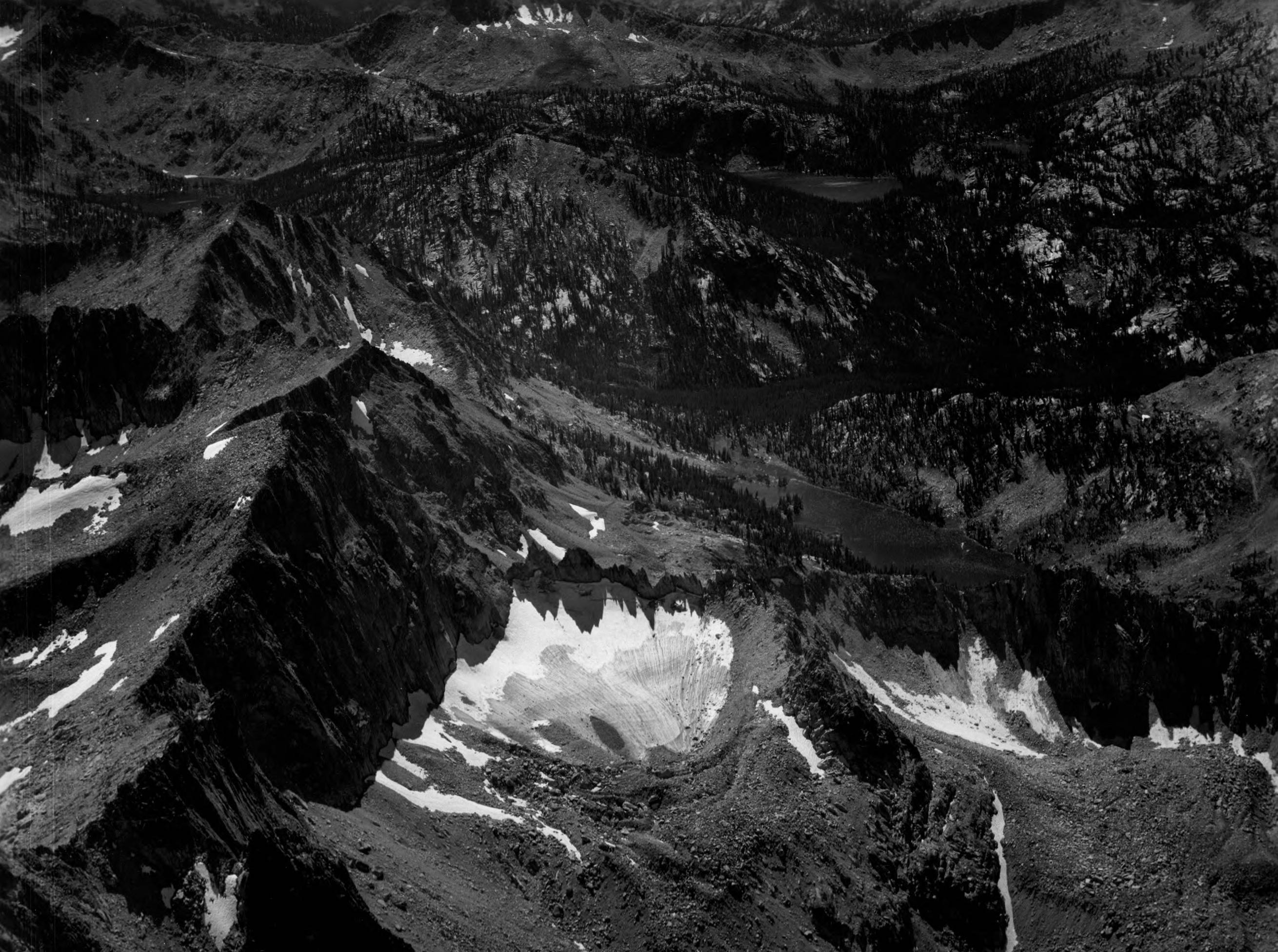
- Description:
- Photo caption: 'Looking SW from position over Mt. Cramer. Payette Peak in the upper left corner. All lakes shown drain into South Fork of the Payette River, which goes off the picture in timbered valley at right. This is very head of the SouthFork of the Payette River. Main Sawtooth Divide on left, Mt. in upper center with top cut off and snow spots near base is Glens Peak. Drainage thru the large lake in upper right is Tenlake Creek.'
- Subjects:
- mountains peaks drainage rivers creeks lakes ridges aerial
- Location:
- Boise County, Idaho Custer County, Idaho
- Idaho County:
- Boise County Custer County
- Features:
- Mount Cramer
- Latitude:
- 44.01102
- Longitude:
- -114.98258
- Source Identifier:
- NARA10StlPht49
- Type:
- image;stillimage
- Format:
- image/jpeg
- Language:
- eng
U of I Digital Collections contain unique digitized and born digital archival materials in a variety of formats. The Library is committed to ensuring our resources are accessible to all users. Please contact us if you need support accessing or using this archived content.
Contact us about this record Library HelpAttribution
- Citation:
- "Lakes and mountains around South for of Payette River", Archival Idaho Photograph Collection, University of Idaho Library Digital Collections, https://www.lib.uidaho.edu/digital/archivalidaho/items/archivalidaho40.html
Rights
- Rights:
- Material determined to be in Public Domain based on date of publication. Material made available by the University of Idaho Library. Please note these materials are not held by University of Idaho Library Special Collections and Archives. For more information, please contact the institution listed in the Source.
- Standardized Rights:
- https://creativecommons.org/publicdomain/mark/1.0/