
IMAGE
Flood control project, Clark Fork River, Kalispel Reservation Item Info
- Title:
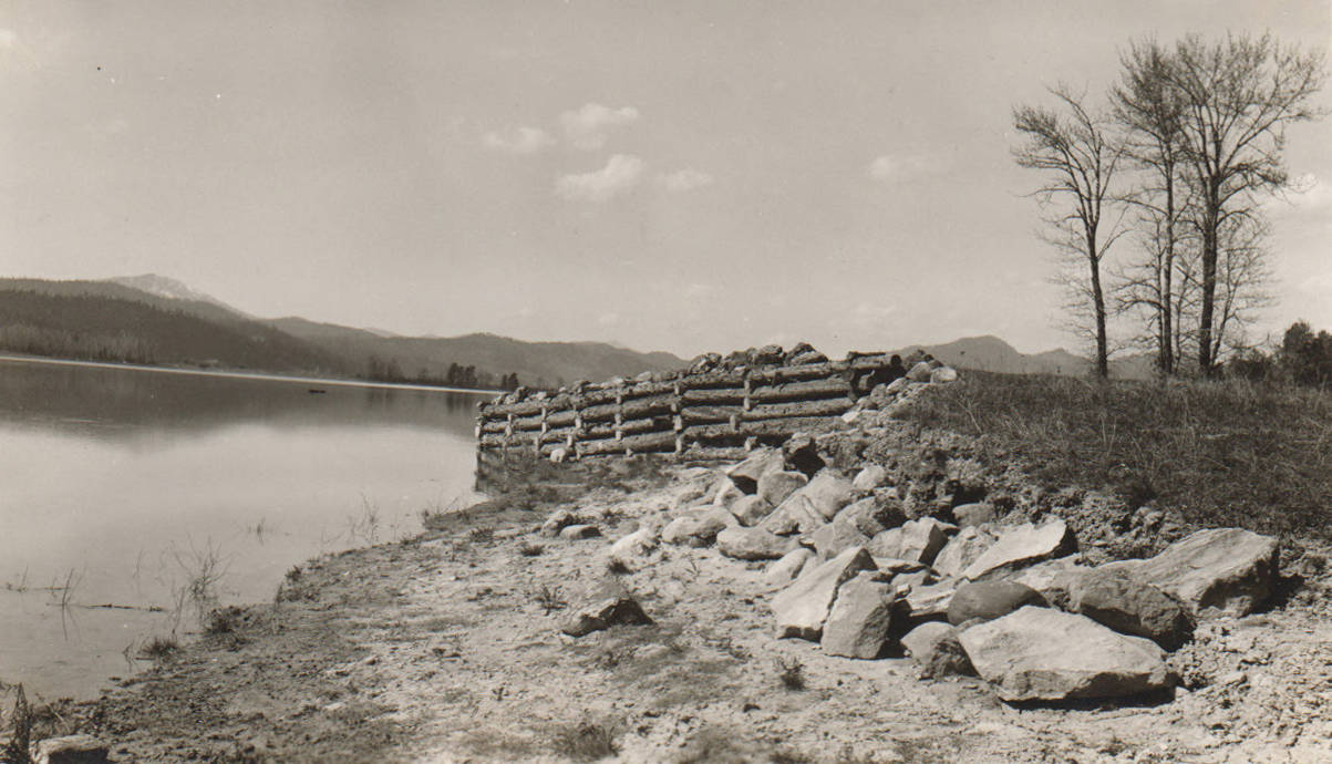
- Flood control project, Clark Fork River, Kalispel Reservation
- Photographer:
- Johnston, S.L.
- Date Created (ISO Standard):
- 1938
- Description:
- Photo text: 'Rip-rap and Flood Control Project. Completed in 1937. Located along Clark Fork River -- Kalispel Indian Reservation. Picture taken in April, 1938.' Note: This image is part of a pictorial supplement to a report on the North Idaho Agency and the Civilian Conservation Corps - Indian Division by Sidney L. Johnston, Assoc. Forest Engineer.
- Subjects:
- CCC Civilian Conservation Corps Indian division roads floods flooding debris erosion control
- Location:
- Clark Fork, Idaho
- Idaho County:
- Bonner County
- Latitude:
- 48.143606
- Longitude:
- -116.205964
- Source:
- NARA DC; RG 75; E 1000 CCC - Indian Division; North Idaho Agency; Box 151
- Source Identifier:
- NARA16DC238b
- Type:
- image;stillimage
- Format:
- image/jpeg
- Language:
- eng
U of I Digital Collections contain unique digitized and born digital archival materials in a variety of formats. The Library is committed to ensuring our resources are accessible to all users. Please contact us if you need support accessing or using this archived content.
Contact us about this record Library HelpAttribution
- Citation:
- "Flood control project, Clark Fork River, Kalispel Reservation", Archival Idaho Photograph Collection, University of Idaho Library Digital Collections, https://www.lib.uidaho.edu/digital/archivalidaho/items/archivalidaho95.html
Rights
- Rights:
- In Copyright - Educational Use Permitted. Please note these materials are not held by University of Idaho Library Special Collections and Archives. For more information, please contact the institution listed in the Source.
- Standardized Rights:
- http://rightsstatements.org/vocab/InC-EDU/1.0/