
IMAGE
Dworshak Dam Project 26 (Aerial view of dam site) Item Info
- Title:
- Dworshak Dam Project 26 (Aerial view of dam site)
- Date Created (ISO Standard):
- 1955
- Description:
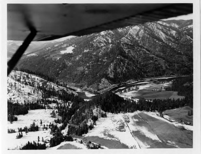
- Aerial view of dam site. Showing a little farm land - the Merry place just under the plane.
- Subjects:
- dworshak dam project aerial views dam site farm plane merry
- Idaho County:
- Clearwater County
- Latitude:
- 46.513913
- Longitude:
- -116.297579
- Source:
- MG 147
- Source Identifier:
- 13-00724
- Original Format:
- black and white photograph
- Type:
- Image;StillImage
- Format:
- image/jpeg
- Language:
- eng
U of I Digital Collections contain unique digitized and born digital archival materials in a variety of formats. The Library is committed to ensuring our resources are accessible to all users. Please contact us if you need support accessing or using this archived content.
Contact us about this record Library HelpAttribution
- Citation:
- "Dworshak Dam Project 26 (Aerial view of dam site)", Dworshak Dam Collection, University of Idaho Library Digital Collections, https://www.lib.uidaho.edu/digital/dworshak/items/dworshak512.html
Rights
- Rights:
- Material produced by the United States Army Corp of Engineers and is in Public Domain. For more information, please contact University of Idaho Library Special Collections and Archives Department at libspec@uidaho.edu
- Standardized Rights:
- https://creativecommons.org/publicdomain/mark/1.0/