
IMAGE
Goat Creek, Mount Cramer, and surrounding peaks Item Info
- Title:
- Goat Creek, Mount Cramer, and surrounding peaks
- Photographer:
- Stevens, A.W.
- Date Created (ISO Standard):
- 1925
- Description:
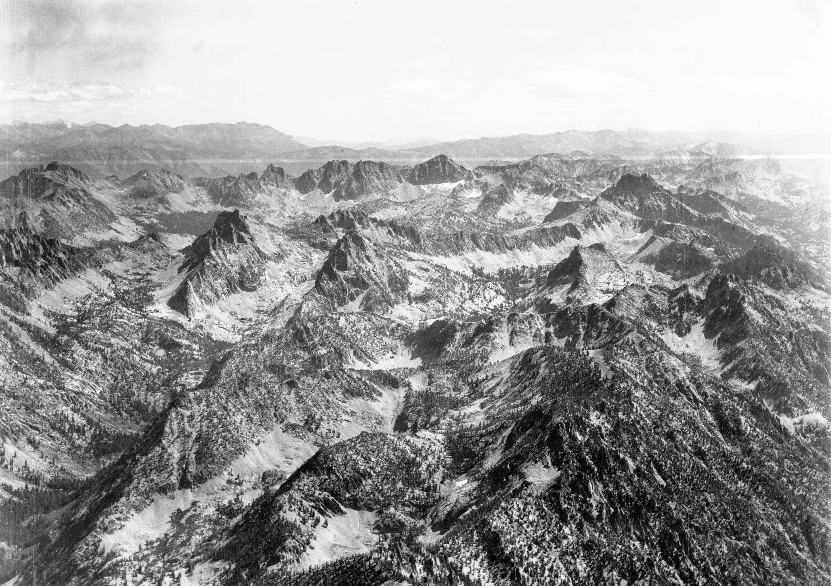
- Photo caption: 'The ridge to the immediate foreground is the divide between Goat Creek and the South Fork of the Payette River. The well defined dark peak in the upper center is Mount Cramer. Other peaks showing are Elk Peak, Reward Peak, Packrat Peak, Red Fish Peak, Coney Peak. Main drainage on the left is Goat Creek. All the drainage this side of Packrat Peak and Elk Peak and left of Cony Peak flows into Goat Creek. The drainage heading just right of Coney Peak is Garden Creek. Directly behind Packrat Peak and left of Elk Peak is the head of Red Fish Creek.
- Subjects:
- mountains peaks drainage rivers creeks lakes ridges aerial
- Location:
- Boise County, Idaho
- Idaho County:
- Boise County
- Features:
- Bugle Mountain
- Latitude:
- 44.057475
- Longitude:
- -115.172046
- Source:
- Army Air Corps - Airscapes Idaho
- Source Identifier:
- Army58
- Type:
- image;stillimage
- Format:
- image/jpeg
- Language:
- eng
U of I Digital Collections contain unique digitized and born digital archival materials in a variety of formats. The Library is committed to ensuring our resources are accessible to all users. Please contact us if you need support accessing or using this archived content.
Contact us about this record Library HelpAttribution
- Citation:
- "Goat Creek, Mount Cramer, and surrounding peaks", Archival Idaho Photograph Collection, University of Idaho Library Digital Collections, https://www.lib.uidaho.edu/digital/archivalidaho/items/archivalidaho258.html
Rights
- Rights:
- Material determined to be in Public Domain based on date of publication. Material made available by the University of Idaho Library. Please note these materials are not held by University of Idaho Library Special Collections and Archives. For more information, please contact the institution listed in the Source.
- Standardized Rights:
- https://creativecommons.org/publicdomain/mark/1.0/