
IMAGE
Map of Proposed Reservation [text] Item Info
- Title:
- Map of Proposed Reservation [text]
- Photographer:
- Office of Indian Affairs, Dept. of the Interior
- Date Created (ISO Standard):
- 1873
- Description:
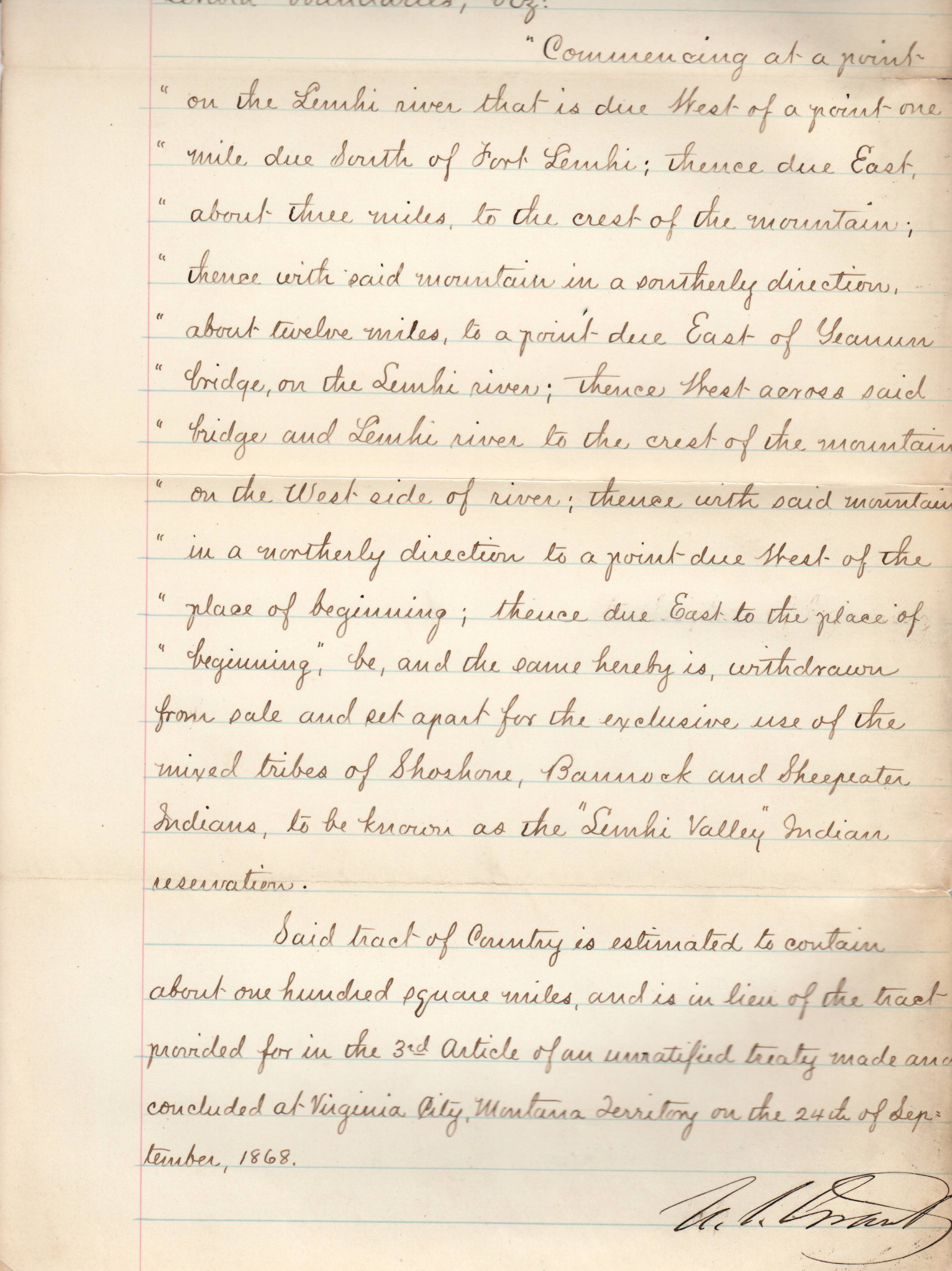
- Text with map of the proposed Nez Perce Indian Reservation in 1873 in the Wallowa Valley, Oregon.
- Subjects:
- map reservation Nez Perce Indian division tribes reservations Office of Indian division Affairs tribes
- Location:
- Wallowa Valley, Oregon
- Latitude:
- 45.520659
- Longitude:
- -117.424338
- Source:
- NARA DC; RG 75 E107 Executive Order File Box 2 Wallowa Valley
- Source Identifier:
- NARA16DC5
- Type:
- image;stillimage
- Format:
- image/jpeg
- Language:
- eng
U of I Digital Collections contain unique digitized and born digital archival materials in a variety of formats. The Library is committed to ensuring our resources are accessible to all users. Please contact us if you need support accessing or using this archived content.
Contact us about this record Library HelpAttribution
- Citation:
- "Map of Proposed Reservation [text]", Archival Idaho Photograph Collection, University of Idaho Library Digital Collections, https://www.lib.uidaho.edu/digital/archivalidaho/items/archivalidaho347.html
Rights
- Rights:
- Material determined to be in Public Domain based on date of publication. Material made available by the University of Idaho Library. Please note these materials are not held by University of Idaho Library Special Collections and Archives. For more information, please contact the institution listed in the Source.
- Standardized Rights:
- https://creativecommons.org/publicdomain/mark/1.0/