
IMAGE
Goat Creek near South Fork of Payette and surrounding peaks Item Info
- Title:
- Goat Creek near South Fork of Payette and surrounding peaks
- Photographer:
- Stevens, A.W.
- Date Created (ISO Standard):
- 1925
- Description:
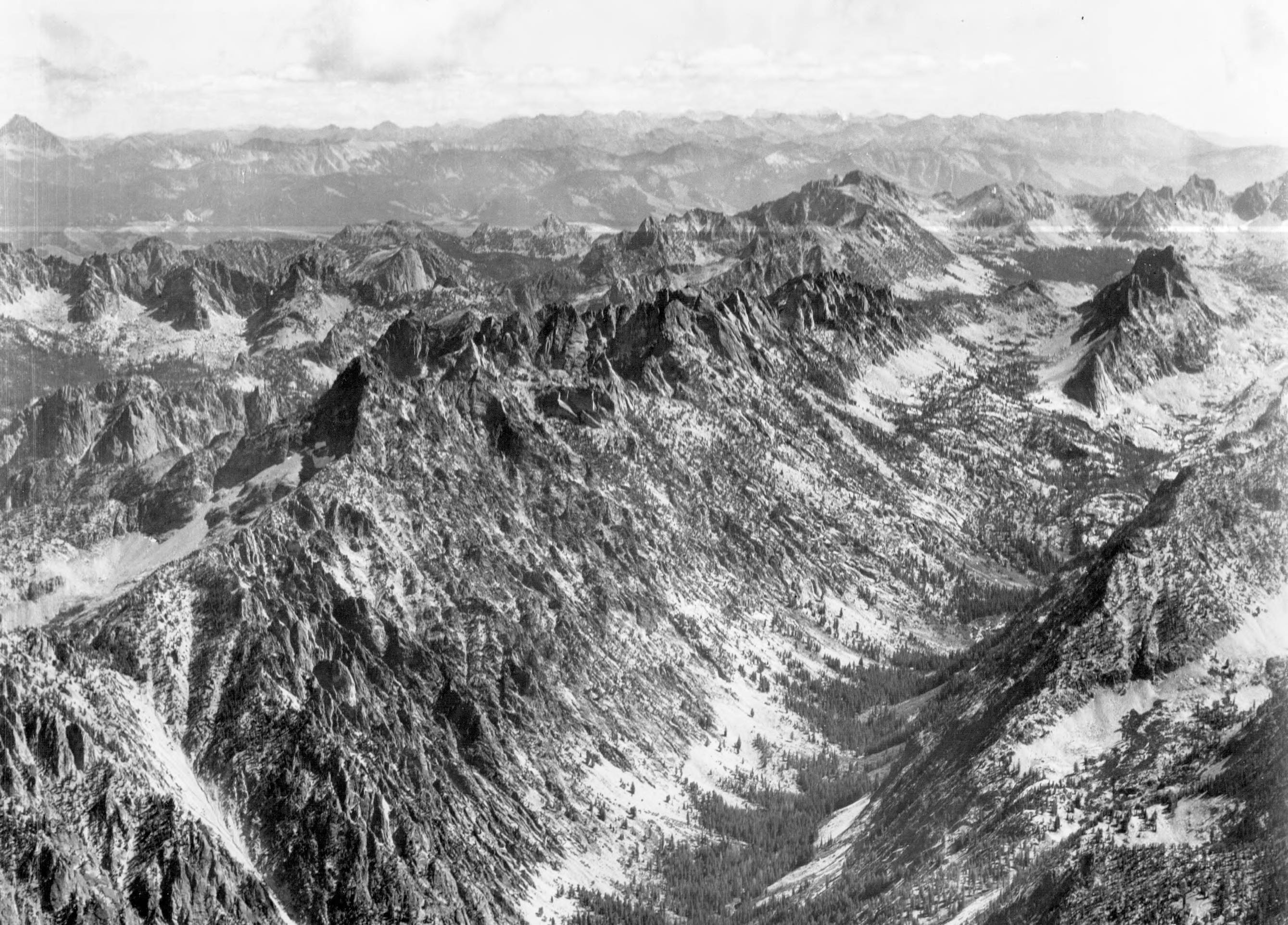
- Photo caption: 'Looking east from a position over the point on ridge between Goat Creek and South Fork of Payette River. Main drainage in foreground is Goat Creek. Other peaks showing are Branson Peal, Tohobit Peak, Warbonnet Peak, and Red Fish Peak.'
- Subjects:
- mountains peaks drainage rivers creeks lakes ridges aerial
- Location:
- Sawtooth National Forest, Idaho
- Idaho County:
- Boise County
- Features:
- Goat Creek
- Latitude:
- 44.11129
- Longitude:
- -115.14537
- Source:
- Army Air Corps - Airscapes Idaho
- Source Identifier:
- Army57
- Type:
- image;stillimage
- Format:
- image/jpeg
- Language:
- eng
U of I Digital Collections contain unique digitized and born digital archival materials in a variety of formats. The Library is committed to ensuring our resources are accessible to all users. Please contact us if you need support accessing or using this archived content.
Contact us about this record Library HelpAttribution
- Citation:
- "Goat Creek near South Fork of Payette and surrounding peaks", Archival Idaho Photograph Collection, University of Idaho Library Digital Collections, https://www.lib.uidaho.edu/digital/archivalidaho/items/archivalidaho527.html
Rights
- Rights:
- Material determined to be in Public Domain based on date of publication. Material made available by the University of Idaho Library. Please note these materials are not held by University of Idaho Library Special Collections and Archives. For more information, please contact the institution listed in the Source.
- Standardized Rights:
- https://creativecommons.org/publicdomain/mark/1.0/