
IMAGE
Lewiston, Idaho and Clarkston, Washington, aerial Item Info
- Title:
- Lewiston, Idaho and Clarkston, Washington, aerial
- Photographer:
- Chief, Militia Bureau
- Date Created (ISO Standard):
- 1931
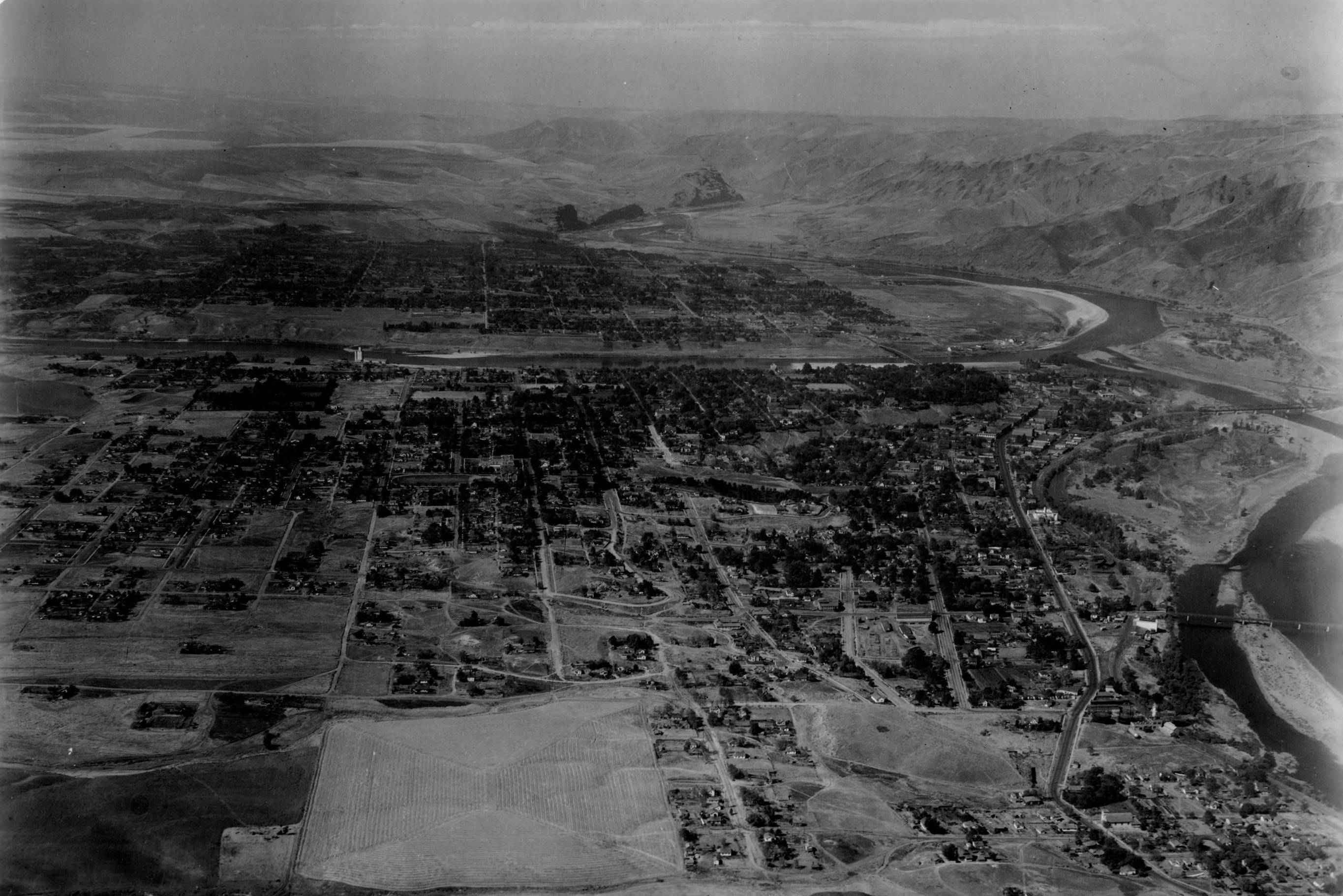
- Description:
- Aerial view of Lewiston, Idaho and Clarkston, Washington. The Clearwater River (lower-left) feeds into the Snake River which forms part of the border between Idaho and Washington (just above image center). The Snake River flows west toward the Columbia River (upper-right).
- Subjects:
- cities towns aerial rivers
- Location:
- Lewiston, Idaho Clarkston, Washington
- Idaho County:
- Nez Perce County
- Latitude:
- 46.41698
- Longitude:
- -117.01605
- Source Identifier:
- NARA10StlPht42
- Type:
- image;stillimage
- Format:
- image/jpeg
- Language:
- eng
U of I Digital Collections contain unique digitized and born digital archival materials in a variety of formats. The Library is committed to ensuring our resources are accessible to all users. Please contact us if you need support accessing or using this archived content.
Contact us about this record Library HelpAttribution
- Citation:
- "Lewiston, Idaho and Clarkston, Washington, aerial", Archival Idaho Photograph Collection, University of Idaho Library Digital Collections, https://www.lib.uidaho.edu/digital/archivalidaho/items/archivalidaho64.html
Rights
- Rights:
- In Copyright - Educational Use Permitted. Please note these materials are not held by University of Idaho Library Special Collections and Archives. For more information, please contact the institution listed in the Source.
- Standardized Rights:
- http://rightsstatements.org/vocab/InC-EDU/1.0/