
IMAGE
Lewis-Clark Airport, Lewiston, aerial Item Info
- Title:
- Lewis-Clark Airport, Lewiston, aerial
- Date Created (ISO Standard):
- 1936
- Description:
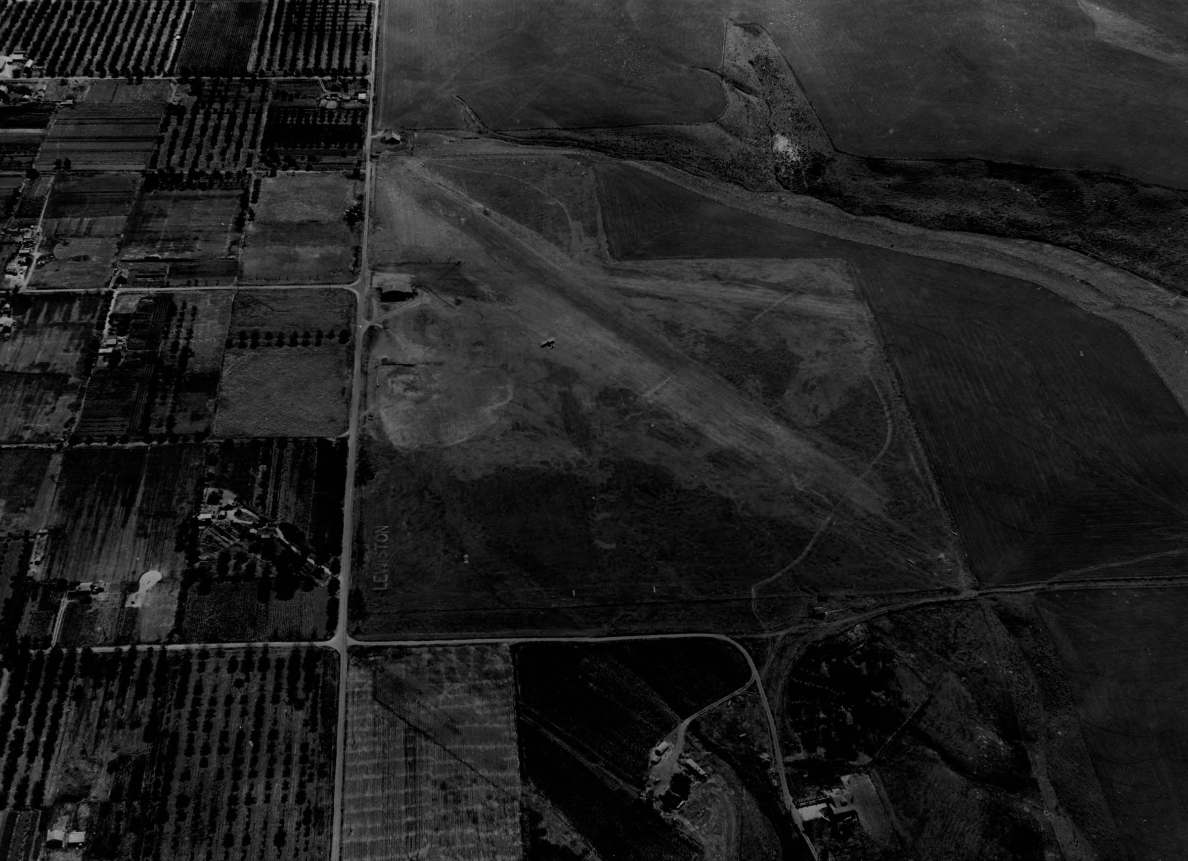
- Aerial image of rudimentary gravel airstrips as part of the original Lewis-Clark Airport. This site was constructed in 1933. In 1944, on an adjoining plot to the northwest, the current Lewiston-Nez Perce County Regional Airport was constructed.
- Subjects:
- airport air strip landing field runway city aerial survey
- Location:
- Lewiston, Idaho
- Idaho County:
- Nez Perce County
- Latitude:
- 46.38502
- Longitude:
- -117.015481
- Source Identifier:
- NARA10StlPht18
- Type:
- image;stillimage
- Format:
- image/jpeg
- Language:
- eng
U of I Digital Collections contain unique digitized and born digital archival materials in a variety of formats. The Library is committed to ensuring our resources are accessible to all users. Please contact us if you need support accessing or using this archived content.
Contact us about this record Library HelpAttribution
- Citation:
- "Lewis-Clark Airport, Lewiston, aerial", Archival Idaho Photograph Collection, University of Idaho Library Digital Collections, https://www.lib.uidaho.edu/digital/archivalidaho/items/archivalidaho732.html
Rights
- Rights:
- Material determined to be in Public Domain based on date of publication. Material made available by the University of Idaho Library. Please note these materials are not held by University of Idaho Library Special Collections and Archives. For more information, please contact the institution listed in the Source.
- Standardized Rights:
- http://rightsstatements.org/vocab/InC-EDU/1.0/