
PDF
Corps of Engineers Map showing power plants, dams, and rivers in the NW Item Info
- Title:
- Corps of Engineers Map showing power plants, dams, and rivers in the NW
- Creator:
- United States Army Corps of Engineers
- Date Created (ISO Standard):
- 1957
- Approximated Date:
- yes
- Description:
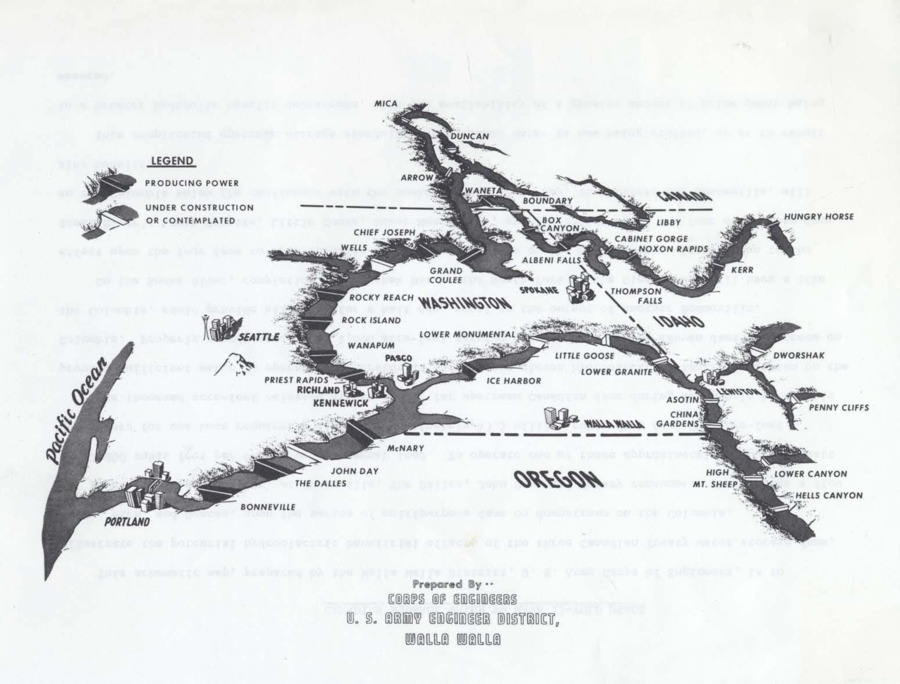
- A Corps of Engineers Map showing power plants, dams, and rivers in the NW and a page titled "Canadian Storage Water to Have 11-Fold Usage" which explains the map.
- Subjects:
- army corps of engineers dams snake river
- Idaho County:
- Clearwater County
- Source:
- MG 147
- Source Identifier:
- 03-1a-006
- Original Format:
- map
- Type:
- Text
- Format:
- application/pdf
- Language:
- eng
U of I Digital Collections contain unique digitized and born digital archival materials in a variety of formats. The Library is committed to ensuring our resources are accessible to all users. Please contact us if you need support accessing or using this archived content.
Contact us about this record Library HelpAttribution
- Citation:
- "Corps of Engineers Map showing power plants, dams, and rivers in the NW", Dworshak Dam Collection, University of Idaho Library Digital Collections, https://www.lib.uidaho.edu/digital/dworshak/items/dworshak1016.html
Rights
- Rights:
- Material produced by the United States Army Corp of Engineers and is in Public Domain. For more information, please contact University of Idaho Library Special Collections and Archives Department at libspec@uidaho.edu
- Standardized Rights:
- https://creativecommons.org/publicdomain/mark/1.0/