
IMAGE
Dworshak Dam Project 2 (Possible bridge sites) Item Info
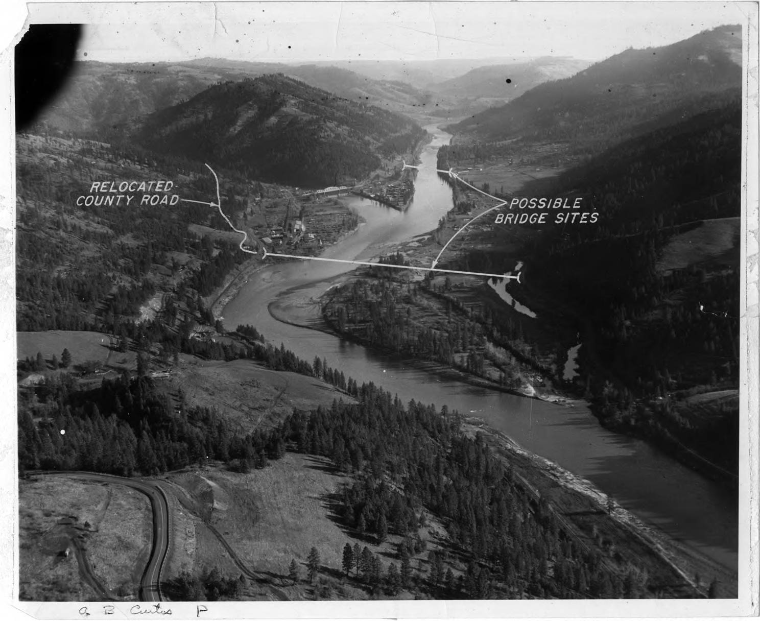
- Title:
- Dworshak Dam Project 2 (Possible bridge sites)
- Date Created (ISO Standard):
- 1965
- Description:
- Possible bridge sites and relocated county road. Note on back: "During the planning stages we wanted a bridge across the main river just below Ahsahka. It was to be an Army construction type of bridge and we were working with the State Highway to get it to be a bridge for public use. Army wanted it to haul cement and route for workers to come to the job- a saving for labor transportation, etc. The state was to put some money into it and make it a public bridge, the Army wanted to tear it down after construction. To make a long story short, the state was willing but the Army backed out of the deal and elected to divert the travel across the bridge at Orofino rather than go to the expense of a new bridge. The markings are Army. This shows the forks of the river well. (A.B. Curtis)"
- Subjects:
- dworshak dam project roads bridges forests
- Idaho County:
- Clearwater County
- Latitude:
- 46.515758
- Longitude:
- -116.298196
- Source:
- MG 147
- Source Identifier:
- 13-00695
- Original Format:
- black and white photograph
- Type:
- Image;StillImage
- Format:
- image/jpeg
- Language:
- eng
U of I Digital Collections contain unique digitized and born digital archival materials in a variety of formats. The Library is committed to ensuring our resources are accessible to all users. Please contact us if you need support accessing or using this archived content.
Contact us about this record Library HelpAttribution
- Citation:
- "Dworshak Dam Project 2 (Possible bridge sites)", Dworshak Dam Collection, University of Idaho Library Digital Collections, https://www.lib.uidaho.edu/digital/dworshak/items/dworshak618.html
Rights
- Rights:
- Material produced by the United States Army Corp of Engineers and is in Public Domain. For more information, please contact University of Idaho Library Special Collections and Archives Department at libspec@uidaho.edu
- Standardized Rights:
- https://creativecommons.org/publicdomain/mark/1.0/