
IMAGE
Dworshak Dam Project 175 (aerial view) Item Info
- Title:
- Dworshak Dam Project 175 (aerial view)
- Creator:
- Curtis, Albert B. (Albert Bruce), 1903-1985
- Date Created (ISO Standard):
- 1967
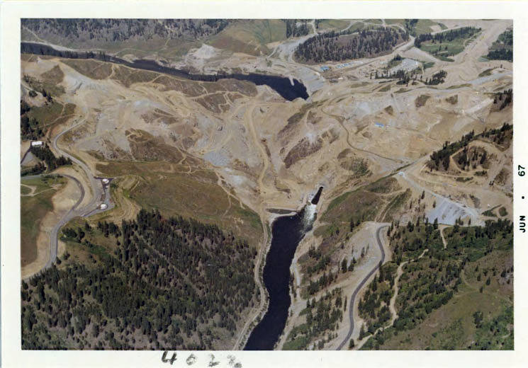
- Description:
- Aerial photograph of the area under construction. You can see the lower coffer dam, upper coffer dam and dry area between, as well as the diversion tunnel. Aerial view from high elevation.
- Subjects:
- dworshak dam project roads aerial views coffer dam upper lower diversion tunnel
- Idaho County:
- Clearwater County
- Latitude:
- 46.515758
- Longitude:
- -116.298196
- Source:
- MG 147
- Source Identifier:
- 13-04023
- Original Format:
- color photograph
- Type:
- Image;StillImage
- Format:
- image/jpeg
- Language:
- eng
U of I Digital Collections contain unique digitized and born digital archival materials in a variety of formats. The Library is committed to ensuring our resources are accessible to all users. Please contact us if you need support accessing or using this archived content.
Contact us about this record Library HelpAttribution
- Citation:
- "Dworshak Dam Project 175 (aerial view)", Dworshak Dam Collection, University of Idaho Library Digital Collections, https://www.lib.uidaho.edu/digital/dworshak/items/dworshak670.html
Rights
- Rights:
- Material produced by the United States Army Corp of Engineers and is in Public Domain. For more information, please contact University of Idaho Library Special Collections and Archives Department at libspec@uidaho.edu
- Standardized Rights:
- https://creativecommons.org/publicdomain/mark/1.0/