
IMAGE
Map explanations Item Info
- Title:
- Map explanations
- Date Created (ISO Standard):
- 1953
- Description:
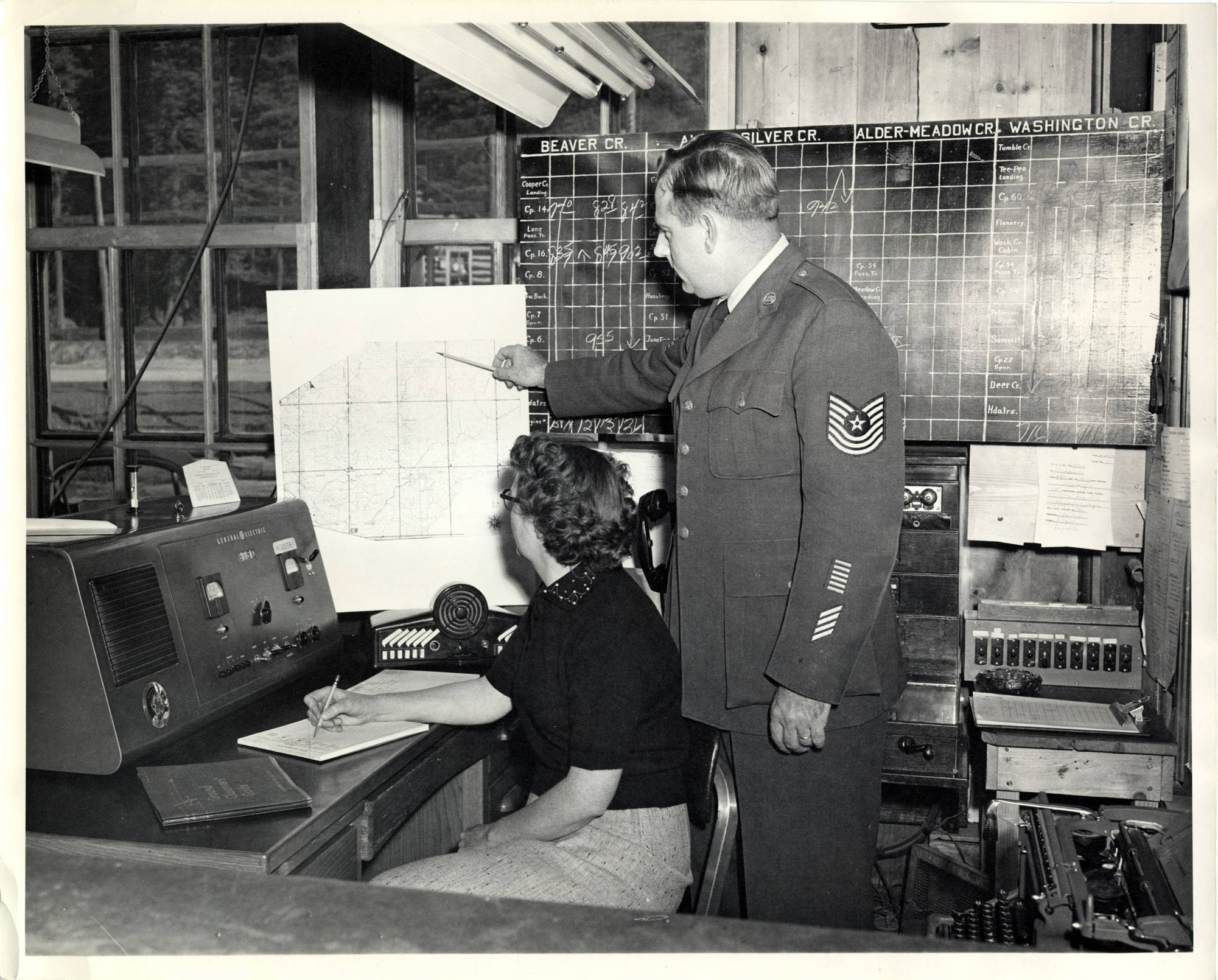
- The description on the back of the photograph reads "Sgt. George Webster, member of Air Force training team, explains use of map to Cora Todd, operator of radio at Headquarters. Blackboard in background is use to control movement of logging trains."
- Subjects:
- training military uniforms clerical workers maps (documents) radio receivers schedules (time plans)
- Location:
- Headquarters, Idaho
- Idaho County:
- Clearwater County
- Latitude:
- 46.62991
- Longitude:
- -115.80931
- Source:
- Potlatch Corporation Historical Archives, 1900-2007, MG 457, University of Idaho Special Collections and Archives
- Source Identifier:
- 457_202_31_008
- Type:
- image;stillimage
- Format:
- image/jpeg
- Language:
- eng
U of I Digital Collections contain unique digitized and born digital archival materials in a variety of formats. The Library is committed to ensuring our resources are accessible to all users. Please contact us if you need support accessing or using this archived content.
Contact us about this record Library HelpAttribution
- Citation:
- "Map explanations", Potlatch Lumber Company Photograph Collection, University of Idaho Library Digital Collections, https://www.lib.uidaho.edu/digital/plcphotos/items/plcphotos1504.html
Rights
- Rights:
- In copyright, educational use permitted. Educational use includes non-commercial reproduction of text and images in materials for teaching and research purposes. For other contexts beyond fair use, including digital reproduction, please contact the University of Idaho Library Special Collections and Archives Department at libspec@uidaho.edu. The University of Idaho Library is not liable for any violations of the law by users.
- Standardized Rights:
- http://rightsstatements.org/vocab/InC-EDU/1.0/