
MULTIPLE (2 Items)
Cottonwood, Idaho. Aerial. Item Info
- Title:
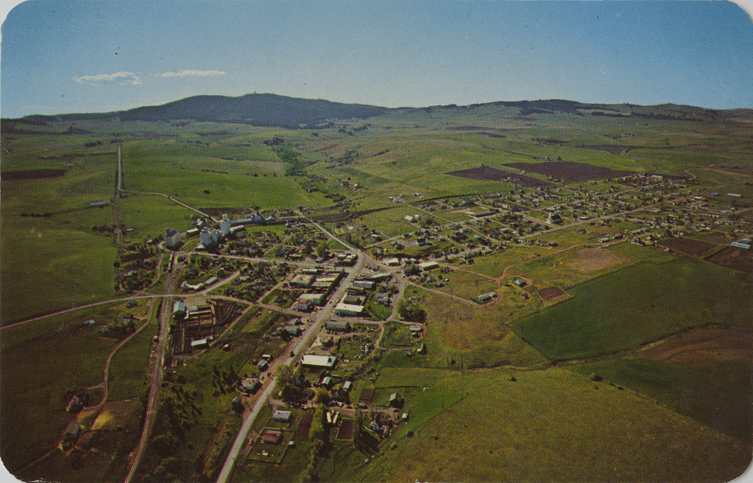
- Cottonwood, Idaho. Aerial.
- Publisher:
- Ross Hall Scenics
- Publisher Location:
- Sandpoint, ID
- Date Created (ISO Standard):
- 1980
- Approximated Date:
- yes
- Description:
- Postcard is an aerial photograph of Cottonwood, Idaho. | Cottonwood in North Idaho. Population 1,100, elevation 3440 on Hwy 95, part of the rich Camas Prairie. Its history dates back to the 1860's, when it was sit of a way-station for mine supplies. Cottonwood was the scene of a skirmish in the Nez Perce War of '77. Fine schools and churches, a diversified economy and recreation make this town attractive for family living.
- Subjects:
- aerial photographs towns mountains buildings streets photographic postcards
- Location:
- Cottonwood, Idaho
- Idaho County:
- Idaho County
- Latitude:
- 46.047591
- Longitude:
- -116.337411
- Source:
- PG 9, Postcard Collection, University of Idaho Library Special Collections and Archives, http://www.lib.uidaho.edu/special-collections/
- Source Identifier:
- pg_9_01_28a
- Type:
- Image;StillImage
- Format:
- image/jpeg
- Language:
- eng
U of I Digital Collections contain unique digitized and born digital archival materials in a variety of formats. The Library is committed to ensuring our resources are accessible to all users. Please contact us if you need support accessing or using this archived content.
Contact us about this record Library HelpAttribution
- Citation:
- "Cottonwood, Idaho. Aerial.", Northwest Historical Postcards Collection, University of Idaho Library Digital Collections, https://www.lib.uidaho.edu/digital/postcards/items/nwpostcards942.html
Rights
- Rights:
- Educational use includes non-commercial use of text and images in materials for teaching and research purposes. Digital reproduction rights granted by University of Idaho Library. For other uses beyond educational use, please contact University of Idaho Library Special Collections and Archives Department at libspec@uidaho.edu.
- Standardized Rights:
- http://rightsstatements.org/vocab/InC-EDU/1.0/