Historical MapsTo view the MrSid file maps you will need either a MrSID Viewer or ExpressView free from LizardTech
David Thompson 1812, a portion of the North-West Territory of the Province of Canada map. Thompson refers to Lake Coeur d'Alene as "Skeetshoo," at the bottom of the map. Courtesy: the University of Montana Mansfield Library. (MrSID)
Lewis and Clark's Track, a segment of the entire map prepared following their return in 1814. (JPG)
Father Pierre DeSmet 1851, from Indian Lands, for D.D. Mitchell. DeSmet uses "Coeur d'Alene" to refer to the lake and "Stietsho or Pointed Heart" to refer to the Schitsu'umsh. Courtesy: the University of Montana Mansfield Library. (MrSID)
Isaac Stevens 1857, drawn by William H. Carlton. Map of the Indian Nations and Tribes of the Terrritory of Washington and of the Territory of Nebraska west of the mouth of the Yellowstone, 1857. Courtesy of MSCUA, University of Washington, neg. # 979.7 W27m. (MrSID)
Joseph Hutchins Colton 1864, from his Map of Oregon, Washington, Idaho, British Columbia and Montana. Notice all the roads running through Schitsu'umsh lands. Courtesy: the University of Montana Mansfield Library. (MrSID)
W. W. de Lacy 1865, from Territory of Montana. Courtesy: the University of Montana Mansfield Library. (MrSID)
Rand McNally "Idaho" of 1876, from the 1956 Pioneer Atlas of the American West. Courtesy: the University of Montana Mansfield Library. (MrSID)

|
|
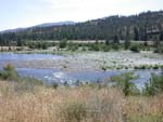 | | Crossing on the Spokane River |
As you review the maps below, also consider the information on the following pages: Aboriginal Territory and Neighbors
Manifest Destiny: War and a Reservation
Manifest Destiny: the Allotment
What's In a Map?, a discussion of the cultural and political significances of "mapping" the land.
Overview of Aboriginal Territory, with the present reservation boundary noted. The aboriginal territory of the Schitsu'umsh encompassed some 5 million acres of what is now eastern Washington, northern Idaho and western Montana, from Lake Pend Oreille in the north to the north fork of the Clearwater River in the south. (JPG)
The 1873 Reservation Boundaries, established by President Ulysses S. Grant in an Executive Order, of some 590,000 acres. On this map the first proposed reservation of some 250,000 acres was proposed by President Andrew Johnson. The "agreement" was never ratified by Congress and, in fact, the Schitsu'umsh were never informed of proposed reservation until 1871. (JPG)
The 1891 Reservation, established by the Executive Order of 1889, of some 400,000 acres. Almost 190,000 acres of ceded land returned to the public domain. It was this agreement that was ratified by the U.S. Congress and formally established the Coeur d'Alene Reservation. (JPG)
The 1894 Reservation, following the Harrison cession. Soon after the establishment of the reservation, whites established a community at the mouth of the Coeur d'Alene River, within the reservation boundaries. Instead of removing the squatters, the federal government acquired the land from the Tribe, moving the boundary of the reservation south by one mile. The Tribe was paid $15,000 for the land cession. (JPG)
The 1910 Reservation, following the Allotment Act, resulted in tribal ownership of some 104,000 acres (allotments indicated in darkened gray). The remaining lands within the reservation, over 240,000 acres, were brought into public dominion and thus white settlement and ownership. There was no compensation for loss made to tribal members. On this map you will also see the land taken as part of the establishment of Heyburn State Park. Between 1908 and 1911, the Schitsu'umsh residents in this area were evicted and the $11,000 compensation was used by the state to develop the park. (JPG)
The Reservation of Today, of some 70,000 acres actually owned by the tribe and tribal members (shaded areas), within a reservation boundary of some 345,000 acres. There are over 1,750 enrolled Coeur d'Alene tribal members today. (JPG)
Maps prepared by John Bottelli, Coeur d'Alene Tribe GIS Program, 1/11/2000.
© Coeur d'Alene Tribe 2002
next >
|
|
|


