
IMAGE
Map Of Northwest Dam Construction Engineer recruitment program) Item Info
- Title:
- Map Of Northwest Dam Construction Engineer recruitment program)
- Creator:
- United States. Army. Corps of Engineers.
- Date Created (ISO Standard):
- 1960
- Description:
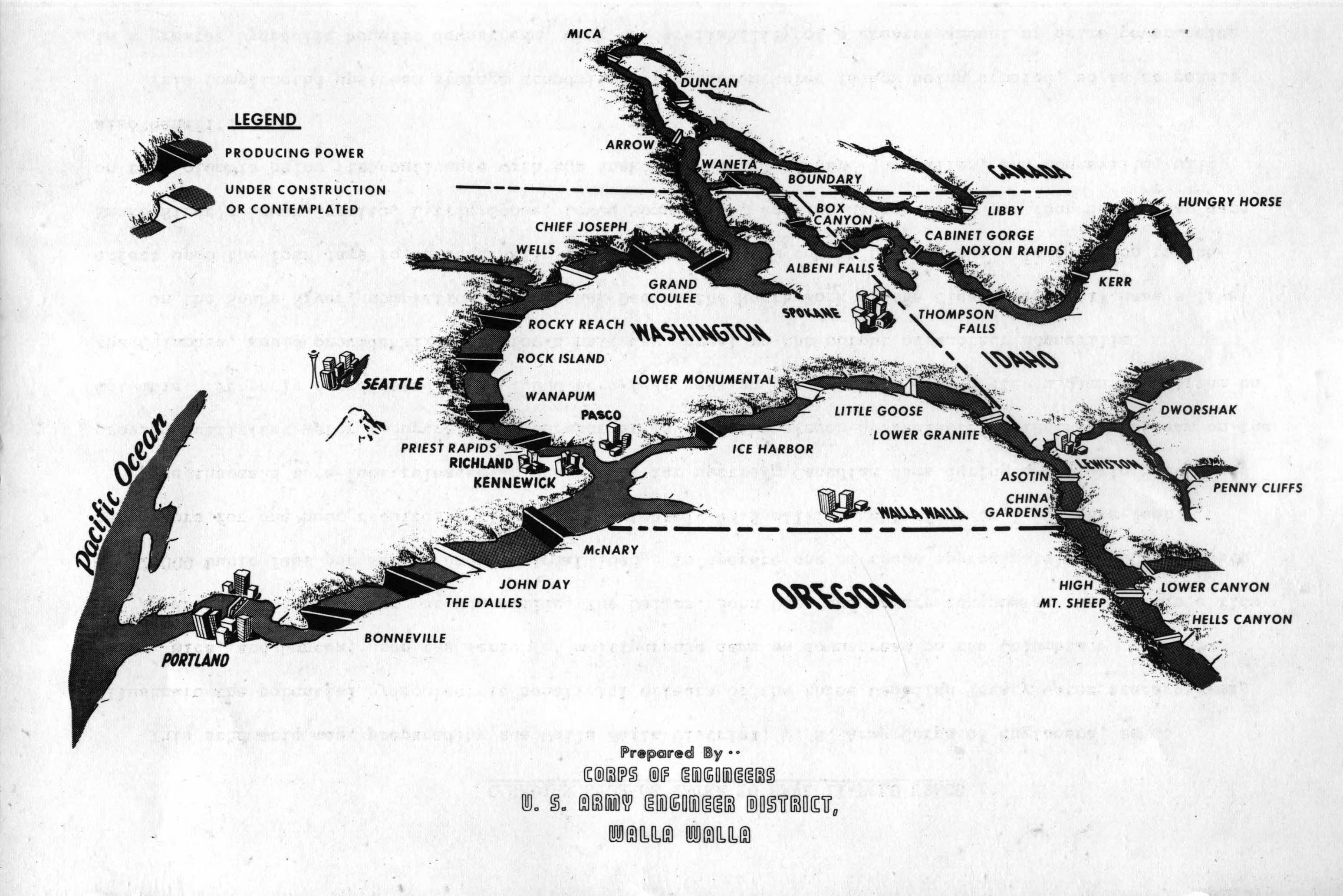
- Artists rendition of the entire Northwest--including existing dams and those that are proposed/under construction
- Subjects:
- dams in U.S. West engineer recruitment program
- Location:
- United States
- Latitude:
- 47.83
- Longitude:
- -118.987
- Publisher:
- University of Idaho Library Digital Initiatives, http://www.lib.uidaho.edu/digital/
- Source:
- Army Corps of Engineers Dam Construction photographs, 1933-1965, PG 94, University of Idaho Library Special Collections and Archives
- Finding Aid:
- https://archiveswest.orbiscascade.org/ark:80444/xv165618
- Source Identifier:
- 94-0-41
- Type:
- Image;StillImage
- Format:
- image/jpeg
- Language:
- eng
U of I Digital Collections contain unique digitized and born digital archival materials in a variety of formats. The Library is committed to ensuring our resources are accessible to all users. Please contact us if you need support accessing or using this archived content.
Contact us about this record Library HelpAttribution
- Citation:
- "Map Of Northwest Dam Construction Engineer recruitment program)", Columbia River Basin Project: Dam Construction in the Pacific Northwest, University of Idaho Library Digital Collections, https://www.lib.uidaho.edu/digital/crbp/items/crbp1342.html
Rights
- Rights:
- In copyright, educational use permitted. Educational use includes non-commercial reproduction of text and images in materials for teaching and research purposes. For other contexts beyond fair use, including digital reproduction, please contact the University of Idaho Library Special Collections and Archives Department at libspec@uidaho.edu. The University of Idaho Library is not liable for any violations of the law by users.
- Standardized Rights:
- http://rightsstatements.org/vocab/InC-EDU/1.0/