
IMAGE
Maps of the Coeur d'Alene mining region, 1899 & 1909; Couer D'Alene Mining Region Item Info
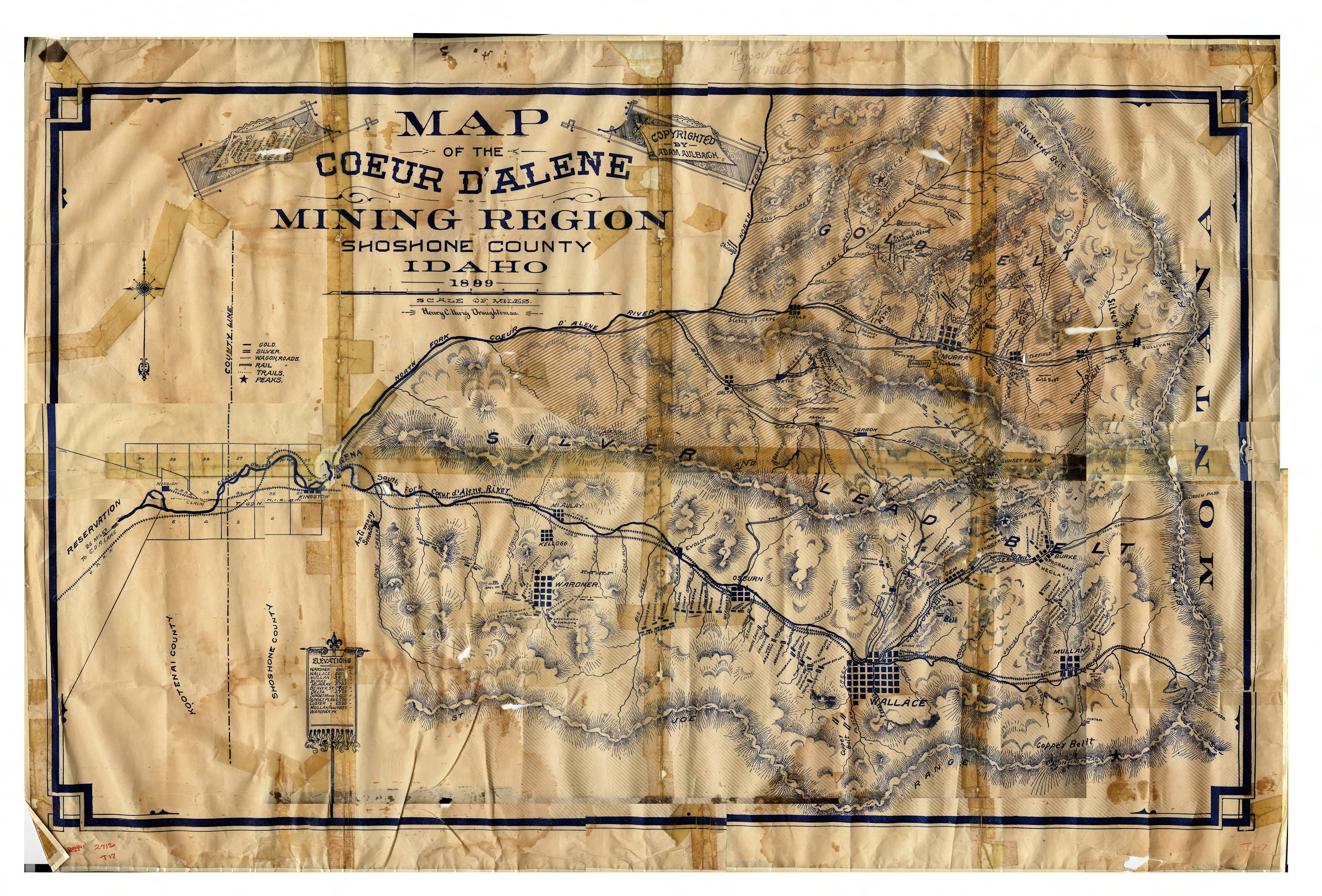
- Title:
- Maps of the Coeur d'Alene mining region, 1899 & 1909; Couer D'Alene Mining Region
- Date Created (ISO Standard):
- 1899
- Description:
- Map of the Couer D'Alene Mining Region 1899
- Coverage:
- United States Idaho Shoshone County
- Source:
- MG 367, T17, 2712, Bunker Hill Company. Records, 1887-1984, University of Idaho Library Special Collections and Archives, http://www.lib.uidaho.edu/special-collections/
- Source Identifier:
- T-17i
- Type:
- Image;StillImage
- Format Original:
- Map
- Format:
- image/jpeg
- Language:
- eng
U of I Digital Collections contain unique digitized and born digital archival materials in a variety of formats. The Library is committed to ensuring our resources are accessible to all users. Please contact us if you need support accessing or using this archived content.
Contact us about this record Library HelpAttribution
- Citation:
- "Maps of the Coeur d'Alene mining region, 1899 & 1909; Couer D'Alene Mining Region", Idaho Historical Maps Collection, University of Idaho Library Digital Collections, https://www.lib.uidaho.edu/digital/historicalmaps/items/spec_hm0.html
Rights
- Rights:
- Material determined to be in Public Domain based on date of publication. Material made available by the University of Idaho Library. For more information, please contact University of Idaho Library Special Collections and Archives Department at libspec@uidaho.edu.
- Standardized Rights:
- https://creativecommons.org/publicdomain/mark/1.0/