
IMAGE
Township map Item Info
- Title:
- Township map
- Date Created (ISO Standard):
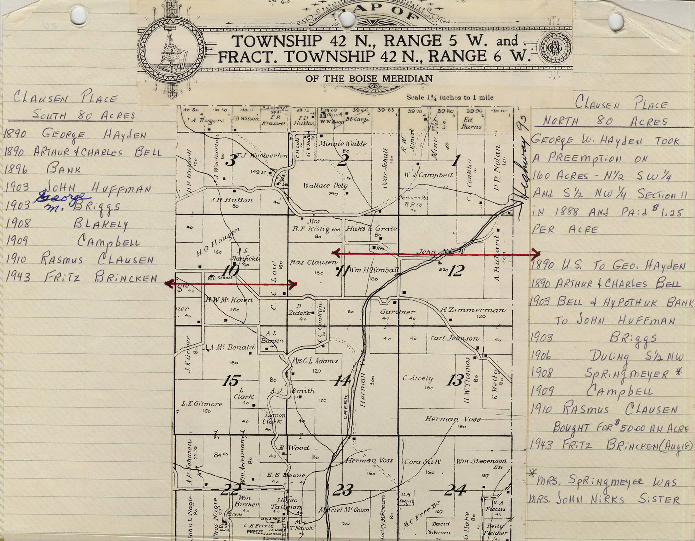
- 1943
- Description:
- Map of Township 42 N., Range 5 W. and Fract. Township 42 N., Range 6 W. of the Boise Maridian. Clausen place 20 acres and Clausen Place North 80 acres. Scale is 1 3/4 inches to 1 mile.
- Subjects:
- maps
- Location:
- Deep Creek, Latah County, Idaho
- Source:
- Lee Gale Scrapbooks: Deep Creek 1, Potlatch Historical Society
- Source Identifier:
- Gale_DeepCreek1-11
- Original Format:
- black and white print
- Type:
- Image;StillImage
- Original Format:
- black and white print
- Format:
- image/jpeg
- Language:
- eng
U of I Digital Collections contain unique digitized and born digital archival materials in a variety of formats. The Library is committed to ensuring our resources are accessible to all users. Please contact us if you need support accessing or using this archived content.
Contact us about this record Library HelpAttribution
- Citation:
- "Township map", Potlatch Historical Society Collection, University of Idaho Library Digital Collections, https://www.lib.uidaho.edu/digital/phs/items/phs1240.html
Rights
- Rights:
- In copyright, educational use permitted. Educational use includes non-commercial reproduction of text and images in materials for teaching and research purposes. For other contexts beyond fair use, including digital reproduction, please contact the University of Idaho Library Special Collections and Archives Department at libspec@uidaho.edu. The University of Idaho Library is not liable for any violations of the law by users.
- Standardized Rights:
- http://rightsstatements.org/vocab/InC-EDU/1.0/