
IMAGE
Hand drawn map of Hampton, ID Item Info
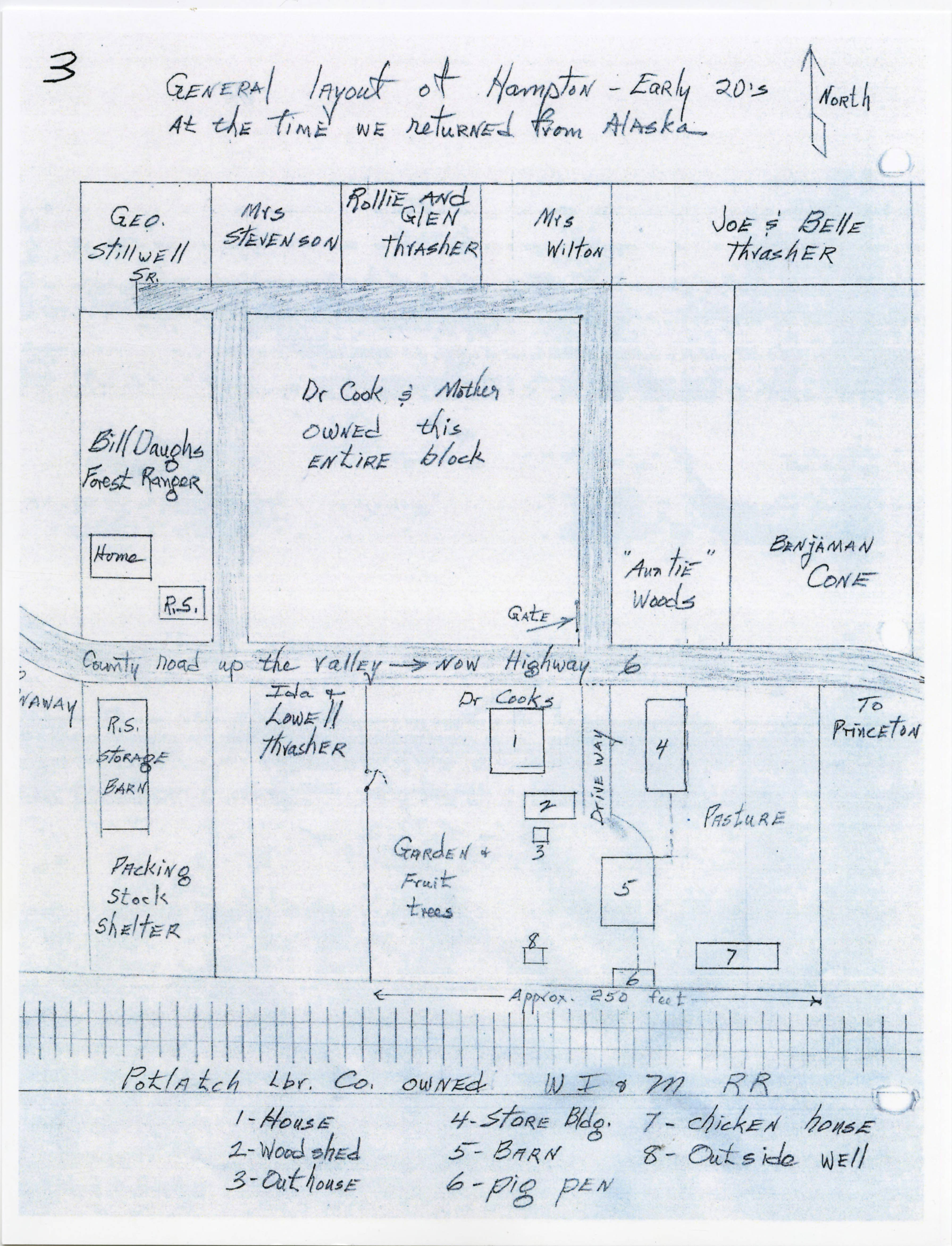
- Title:
- Hand drawn map of Hampton, ID
- Date Created (ISO Standard):
- 1922
- Description:
- Hand drawn map of Hampton, ID with descriptions and locations
- Subjects:
- maps buildings town streets businesses
- Location:
- Princeton, Idaho
- Latitude:
- 46.91428
- Longitude:
- -116.847796
- Source Identifier:
- CH2018_StrongG1_016
- Original Format:
- document
- Type:
- Image;StillImage
- Original Format:
- document
- Format:
- image/jpeg
- Language:
- eng
U of I Digital Collections contain unique digitized and born digital archival materials in a variety of formats. The Library is committed to ensuring our resources are accessible to all users. Please contact us if you need support accessing or using this archived content.
Contact us about this record Library HelpAttribution
- Citation:
- "Hand drawn map of Hampton, ID", Potlatch Historical Society Collection, University of Idaho Library Digital Collections, https://www.lib.uidaho.edu/digital/phs/items/phs1831.html
Rights
- Rights:
- Material has likely passed into public domain. Digital reproductions are made available by University of Idaho Library for educational purposes, and future use should acknowledge this repository. For more information, please contact University of Idaho Library Special Collections and Archives Department at libspec@uidaho.edu. The University of Idaho Library is not liable for any violations of the law by users.
- Standardized Rights:
- http://rightsstatements.org/vocab/NoC-US/1.0/