
MULTIPLE (2 Items)
Shadowy St. Joe River in Northern Idaho. Item Info
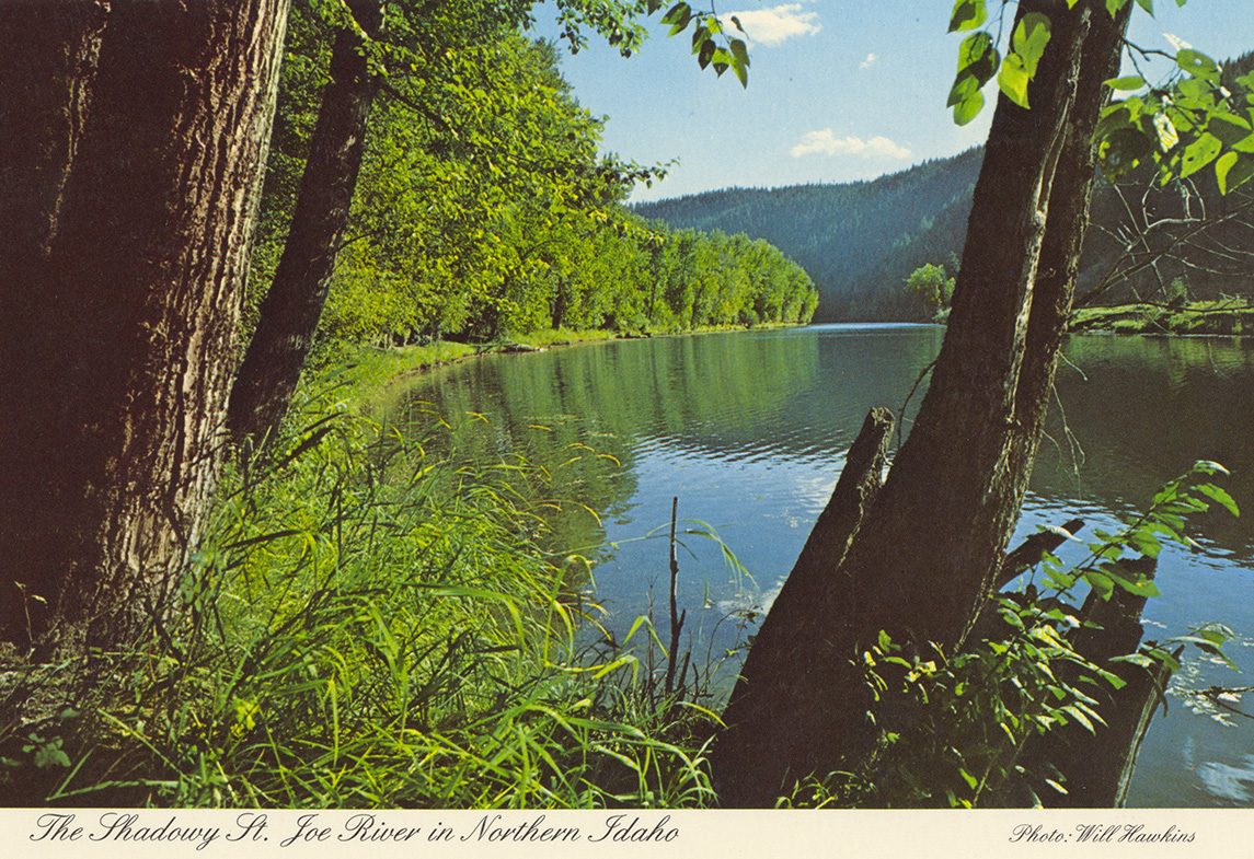
- Title:
- Shadowy St. Joe River in Northern Idaho.
- Photographer:
- Will Hawkins
- Publisher:
- Ross Hall Scenics
- Publisher Location:
- Sandpoint, ID
- Date Created (ISO Standard):
- 1980
- Approximated Date:
- yes
- Description:
- Postcard of the St. Joe River. | Massive Cottonwood trees grace the shores of this serene river along its lower reaches. It is one of the highest navigable rivers in the world, and is used for log towing, boating, and many other water sports. The headwaters drain a portion of the West side of the Bitterroot Mtn. Range on the Idaho-Montana border. It empties into Lake Coeur d'Alene after flowing through Lake Chatcolet. View is near St. Maries, Idaho, enroute to Calder and Avery.
- Subjects:
- rivers trees mountains photographic postcards
- Location:
- St. Joe River; Idaho
- Idaho County:
- Benewah County
- Latitude:
- 47.324338
- Longitude:
- -116.389174
- Source:
- PG 9, Postcard Collection, University of Idaho Library Special Collections and Archives, http://www.lib.uidaho.edu/special-collections/
- Source Identifier:
- pg_9_06_08c
- Type:
- Image;StillImage
- Format:
- image/jpeg
- Language:
- eng
U of I Digital Collections contain unique digitized and born digital archival materials in a variety of formats. The Library is committed to ensuring our resources are accessible to all users. Please contact us if you need support accessing or using this archived content.
Contact us about this record Library HelpAttribution
- Citation:
- "Shadowy St. Joe River in Northern Idaho.", Northwest Historical Postcards Collection, University of Idaho Library Digital Collections, https://www.lib.uidaho.edu/digital/postcards/items/nwpostcards1221.html
Rights
- Rights:
- Educational use includes non-commercial use of text and images in materials for teaching and research purposes. Digital reproduction rights granted by University of Idaho Library. For other uses beyond educational use, please contact University of Idaho Library Special Collections and Archives Department at libspec@uidaho.edu.
- Standardized Rights:
- http://rightsstatements.org/vocab/InC-EDU/1.0/