
MULTIPLE (2 Items)
Lewiston Hill. North of Lewiston, Idaho Item Info
- Title:
- Lewiston Hill. North of Lewiston, Idaho
- Publisher:
- Ross Hall Studio
- Publisher Location:
- Sandpoint, ID
- Date Created (ISO Standard):
- 1970
- Approximated Date:
- yes
- Description:
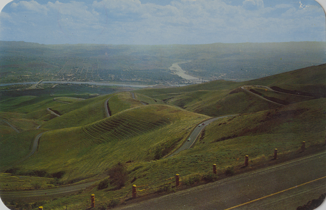
- Postcard of Lewiston, Idaho and Clarkston, Washington and the confluence of the Clearwater and the Snake Rivers. | The Lewiston Hill on Hwy 95. The north-bound motorist leaves Lewiston and ascends 2000 feet over 11 miles of continuously winding road. The confluence of the Clearwater (left) and the Snake Rivers may be seen in the distance
- Subjects:
- rivers cities bridges highways mountains automobiles photographic postcards
- Location:
- Lewiston, Idaho
- Idaho County:
- Nez Perce County
- Latitude:
- 46.460824
- Longitude:
- -117.014888
- Source:
- PG 9, Postcard Collection, University of Idaho Library Special Collections and Archives, http://www.lib.uidaho.edu/special-collections/
- Source Identifier:
- pg_9_17_03b
- Type:
- Image;StillImage
- Format:
- image/jpeg
- Language:
- eng
U of I Digital Collections contain unique digitized and born digital archival materials in a variety of formats. The Library is committed to ensuring our resources are accessible to all users. Please contact us if you need support accessing or using this archived content.
Contact us about this record Library HelpAttribution
- Citation:
- "Lewiston Hill. North of Lewiston, Idaho", Northwest Historical Postcards Collection, University of Idaho Library Digital Collections, https://www.lib.uidaho.edu/digital/postcards/items/nwpostcards1564.html
Rights
- Rights:
- Educational use includes non-commercial use of text and images in materials for teaching and research purposes. Digital reproduction rights granted by University of Idaho Library. For other uses beyond educational use, please contact University of Idaho Library Special Collections and Archives Department at libspec@uidaho.edu.
- Standardized Rights:
- http://rightsstatements.org/vocab/InC-EDU/1.0/