
IMAGE
Whitebird Hill between Grangeville and Whitebird, Idaho Item Info
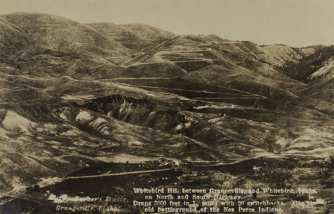
- Title:
- Whitebird Hill between Grangeville and Whitebird, Idaho
- Photographer:
- G.V. Barker
- Publisher:
- Barker's Studio
- Publisher Location:
- Grangeville, ID
- Date Created (ISO Standard):
- 1913
- Approximated Date:
- yes
- Description:
- Postcard is of a winding road near White bird, Idaho. | White bird Hill between Grangeville and White bird, Idaho on North and South Highway. Drops 3000 feet in 12 miles with 20 switchbacks. Also the old battleground of the Nez Perce Indians.
- Subjects:
- highways mountains hills roads trees buildings photographic postcards
- Location:
- White Bird, Idaho
- Idaho County:
- Idaho County
- Latitude:
- 45.756326
- Longitude:
- -116.300683
- Source:
- PG 9, Postcard Collection, University of Idaho Library Special Collections and Archives, http://www.lib.uidaho.edu/special-collections/
- Source Identifier:
- pg_9_327_01
- Type:
- Image;StillImage
- Format:
- image/jpeg
- Language:
- eng
U of I Digital Collections contain unique digitized and born digital archival materials in a variety of formats. The Library is committed to ensuring our resources are accessible to all users. Please contact us if you need support accessing or using this archived content.
Contact us about this record Library HelpAttribution
- Citation:
- "Whitebird Hill between Grangeville and Whitebird, Idaho", Northwest Historical Postcards Collection, University of Idaho Library Digital Collections, https://www.lib.uidaho.edu/digital/postcards/items/nwpostcards1762.html
Rights
- Rights:
- Material determined to be in Public Domain based on date of publication. Material made available by the University of Idaho Library. For more information, please contact University of Idaho Library Special Collections and Archives Department at libspec@uidaho.edu.
- Standardized Rights:
- https://creativecommons.org/publicdomain/mark/1.0/