
MULTIPLE (2 Items)
Moyie River Bridge, Highway 2 Item Info
- Title:
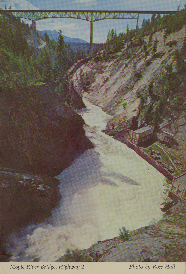
- Moyie River Bridge, Highway 2
- Photographer:
- Ross Hall
- Publisher:
- Ross Hall Scenics
- Publisher Location:
- Sandpoint, ID
- Date Created (ISO Standard):
- 1970
- Approximated Date:
- yes
- Description:
- Postcard is of a bridge near the Moyie Dam near Bonners Ferry, Idaho. | Moyie River Bridge, Highway 2. Moyie River Bridge, 464 ft. high and 1222 ft. long, is located 9 miles northeast of Bonners Ferry on Hwy. 2. This exciting span was finished in 1965, a 3 year project. It is considered to be one of North Idaho's most spectacular highway views. The Bonners Ferry municipal powerhouse is seen at the base of turbulent Moyie Falls. Moyie Falls was a highly regarded scenic point before the bridge was built.
- Subjects:
- cantilever bridges truss bridges rivers buildings trees mountains photographic postcards
- Location:
- Moyie River Canyon Bridge; Bonners Ferry, Idaho; Moyie Dam
- Idaho County:
- Boundary County
- Latitude:
- 48.733635
- Longitude:
- -116.175733
- Source:
- PG 107, Knowles Postcard Collection, University of Idaho Library Special Collections and Archives, http://www.lib.uidaho.edu/special-collections/
- Source Identifier:
- postcard_104
- Type:
- Image;StillImage
- Format:
- image/jpeg
- Language:
- eng
U of I Digital Collections contain unique digitized and born digital archival materials in a variety of formats. The Library is committed to ensuring our resources are accessible to all users. Please contact us if you need support accessing or using this archived content.
Contact us about this record Library HelpAttribution
- Citation:
- "Moyie River Bridge, Highway 2", Northwest Historical Postcards Collection, University of Idaho Library Digital Collections, https://www.lib.uidaho.edu/digital/postcards/items/nwpostcards6.html
Rights
- Rights:
- Educational use includes non-commercial use of text and images in materials for teaching and research purposes. Digital reproduction rights granted by University of Idaho Library. For other uses beyond educational use, please contact University of Idaho Library Special Collections and Archives Department at libspec@uidaho.edu.
- Standardized Rights:
- http://rightsstatements.org/vocab/InC-EDU/1.0/