
MULTIPLE (2 Items)
Lewiston Hill Item Info
- Title:
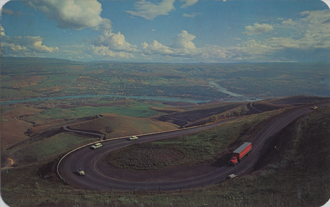
- Lewiston Hill
- Publisher:
- Ross Hall Scenics
- Publisher Location:
- Sandpoint, ID
- Date Created (ISO Standard):
- 1960
- Approximated Date:
- yes
- Description:
- Postcard is a photograph of the old spiral highway above Lewiston, Idaho. | Lewiston Hill - ten miles of continuous curves takes the traveler up 2000 feet to this impressive view of Lewiston, Idaho and Clarkston, Wash. divided by the Snake River. Lewis & Clark traveled down the Clearwater River, which joins the Snake here. These cities have such a milk climate (750' elevation) that the region is known as "the banana belt"
- Subjects:
- highways automobiles rivers hills clouds photographic postcards
- Location:
- Lewiston, Idaho
- Idaho County:
- Nez Perce County
- Latitude:
- 46.461925
- Longitude:
- -117.005732
- Source:
- PG 107, Knowles Postcard Collection, University of Idaho Library Special Collections and Archives, http://www.lib.uidaho.edu/special-collections/
- Source Identifier:
- postcard_081
- Type:
- Image;StillImage
- Format:
- image/jpeg
- Language:
- eng
U of I Digital Collections contain unique digitized and born digital archival materials in a variety of formats. The Library is committed to ensuring our resources are accessible to all users. Please contact us if you need support accessing or using this archived content.
Contact us about this record Library HelpAttribution
- Citation:
- "Lewiston Hill", Northwest Historical Postcards Collection, University of Idaho Library Digital Collections, https://www.lib.uidaho.edu/digital/postcards/items/nwpostcards646.html
Rights
- Rights:
- Educational use includes non-commercial use of text and images in materials for teaching and research purposes. Digital reproduction rights granted by University of Idaho Library. For other uses beyond educational use, please contact University of Idaho Library Special Collections and Archives Department at libspec@uidaho.edu.
- Standardized Rights:
- http://rightsstatements.org/vocab/InC-EDU/1.0/