
IMAGE
Northern Pacific Railroad Map [2] Item Info
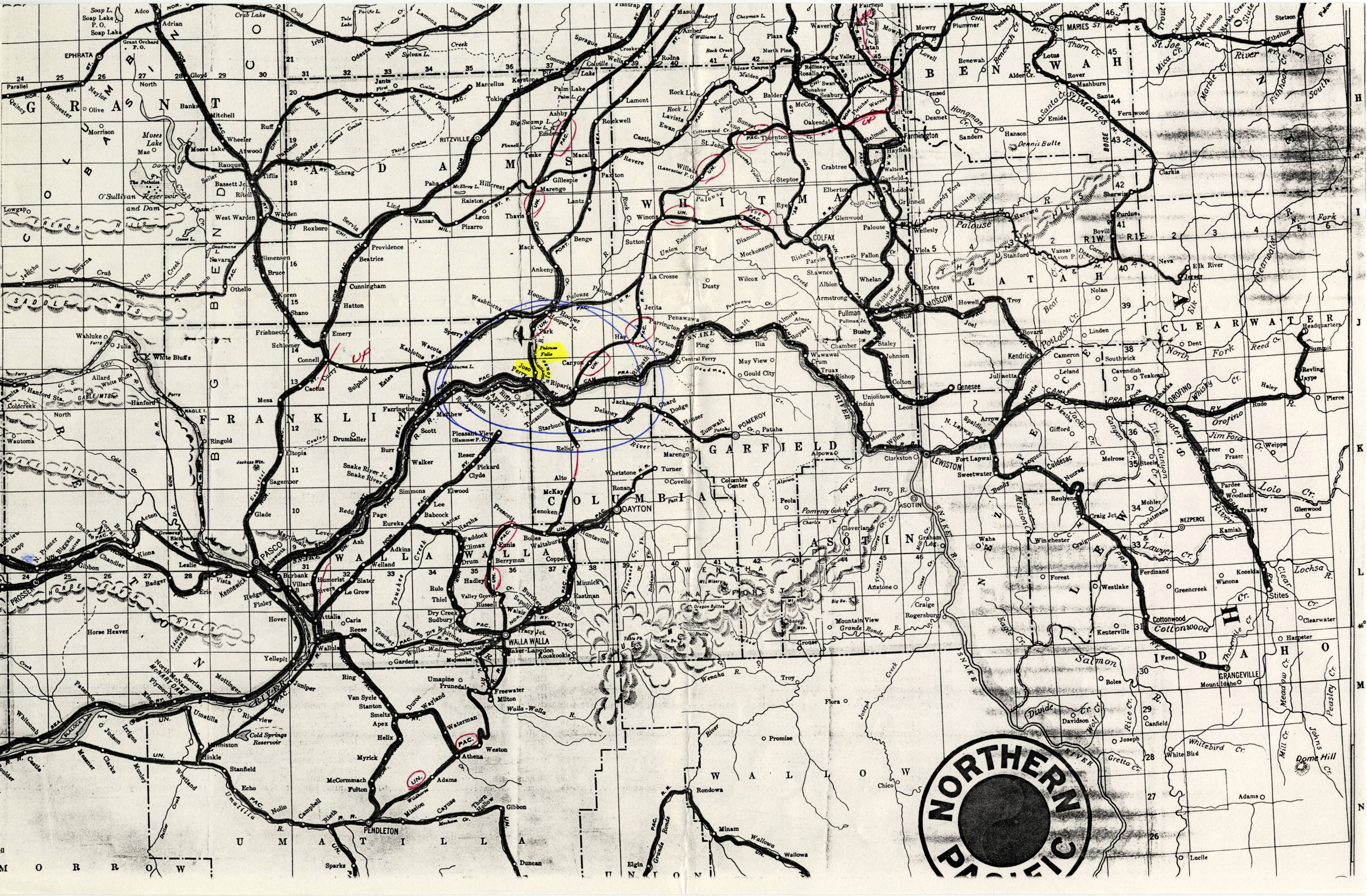
- Title:
- Northern Pacific Railroad Map [2]
- Description:
- A copy of a Northern Pacific Railroad map. The confluence of the Snake and Palouse Rivers, near the Riparia junction, is circled.
- Subjects:
- historical maps location maps line-route maps
- Point of Origin:
- United States; Washington;
- Latitude:
- 46.5784624
- Longitude:
- -118.0870464
- Source:
- MG 183 Hal Riegger Papers, 1981-1986
- Source Identifier:
- MG183_F06_023
- Type:
- image;stillimage
- Original Format:
- Photograph
- Format:
- image/jpeg
U of I Digital Collections contain unique digitized and born digital archival materials in a variety of formats. The Library is committed to ensuring our resources are accessible to all users. Please contact us if you need support accessing or using this archived content.
Contact us about this record Library HelpAttribution
- Citation:
- "Northern Pacific Railroad Map [2]", Hal Riegger Papers, 1981-1986, University of Idaho Library Digital Collections, https://www.lib.uidaho.edu/digital/riegger/items/riegger378.html
Rights
- Rights:
- In copyright, educational use permitted. Educational use includes non-commercial reproduction of text and images in materials for teaching and research purposes. For other contexts beyond fair use, including digital reproduction, please contact the University of Idaho Library Special Collections and Archives Department at libspec@uidaho.edu. The University of Idaho Library is not liable for any violations of the law by users.
- Standardized Rights:
- http://rightsstatements.org/vocab/InC-EDU/1.0/