
PDF
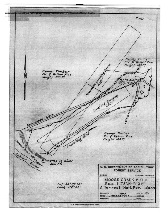
Hand-drawn map of the proposed Moose Creek airstrip extension, c. 1930 (?). Item Info
- Title:
- Hand-drawn map of the proposed Moose Creek airstrip extension, c. 1930 (?).
- Date Created (ISO Standard):
- 1930
- Subjects:
- moose creek airstrip
- Section:
- Wilderness Pages
- Location:
- Selway-Bitterroot Wilderness (Idaho and Mont.)
- Idaho County:
- Idaho County
- Latitude:
- 46.116667
- Longitude:
- -114.933333
- Publisher:
- Unpublished
- Source:
- National Archives and Records Administration, Seattle
- Original URL:
- https://sbw.lib.uidaho.edu/pages.html
- Regional Office Number:
- Unknown
- Source Identifier:
- 62
- Original Format:
- Schematic Drawing
- Type:
- Image;StillImage; Text
- Format:
- application/pdf
- Language:
- eng
U of I Digital Collections contain unique digitized and born digital archival materials in a variety of formats. The Library is committed to ensuring our resources are accessible to all users. Please contact us if you need support accessing or using this archived content.
Contact us about this record Library HelpAttribution
- Citation:
- "Hand-drawn map of the proposed Moose Creek airstrip extension, c. 1930 (?).", The Selway-Bitterroot Wilderness History Project, University of Idaho Library Digital Collections, https://www.lib.uidaho.edu/digital/sbw/items/sbw241.html
Rights
- Rights:
- In Copyright - Educational Use Permitted. For more information, please contact University of Idaho Library Special Collections and Archives Department at libspec@uidaho.edu.
- Standardized Rights:
- http://rightsstatements.org/vocab/InC-EDU/1.0/