
IMAGE
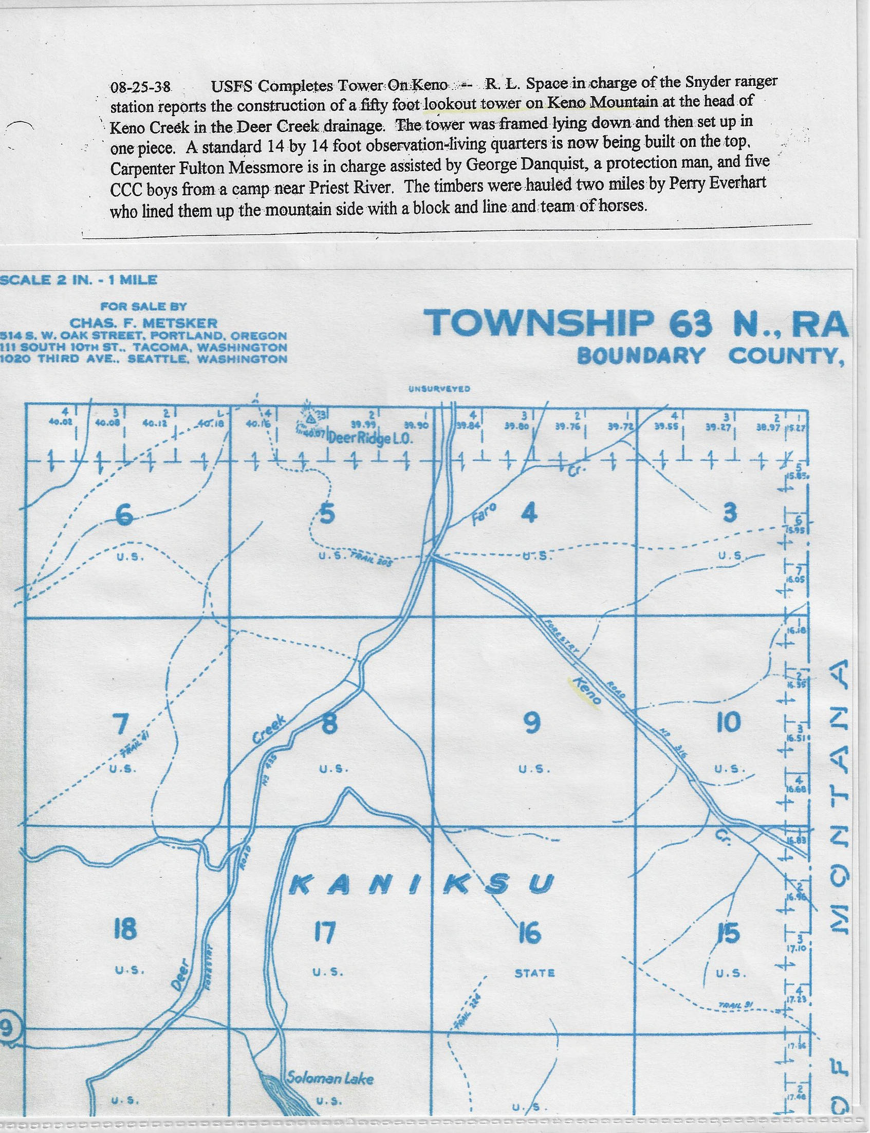
Map of Township 63, Boundary County, Kaniksu National Forest and caption dated 08-25-28 describing the completion of a fire lookout town on Keno Mountain at the head of Keno Creek by a CCC camp near Priest River. Item Info
- Title:
- Map of Township 63, Boundary County, Kaniksu National Forest and caption dated 08-25-28 describing the completion of a fire lookout town on Keno Mountain at the head of Keno Creek by a CCC camp near Priest River.
- Date Created:
- 1938-08-25
- Description:
- Map of Township 63, Boundary County, Kaniksu National Forest and caption dated 08-25-28 describing the completion of a fire lookout town on Keno Mountain at the head of Keno Creek by a CCC camp near Priest River.
- Subjects:
- map lookouts structures fire prevention
- Location:
- Keno Mountain; Boundary County; Deer Creek
- Source:
- Boundary County Museum
- Contributing Institution:
- Boundry County Museum
- Source Identifier:
- ccc41
- Original Format:
- map and description
- Type:
- Image;StillImage
- Format:
- image/jpeg
- Language:
- eng
U of I Digital Collections contain unique digitized and born digital archival materials in a variety of formats. The Library is committed to ensuring our resources are accessible to all users. Please contact us if you need support accessing or using this archived content.
Contact us about this record Library HelpAttribution
- Citation:
- "Map of Township 63, Boundary County, Kaniksu National Forest and caption dated 08-25-28 describing the completion of a fire lookout town on Keno Mountain at the head of Keno Creek by a CCC camp near Priest River.", Civilian Conservation Corps in Idaho Collection, University of Idaho Library Digital Collections, https://www.lib.uidaho.edu/digital/cccidaho/items/cccidaho1839.html
Rights
- Rights:
- In Copyright - Educational Use Permitted. Original materials can be consulted at the Boundry County Museum. Please note these materials are not held by University of Idaho Library Special Collections and Archives. For more information, please contact the institution listed in the Source.
- Standardized Rights:
- http://rightsstatements.org/vocab/InC-EDU/1.0/