
IMAGE
Aerial View Of O'Sullivan Dam Item Info
- Title:
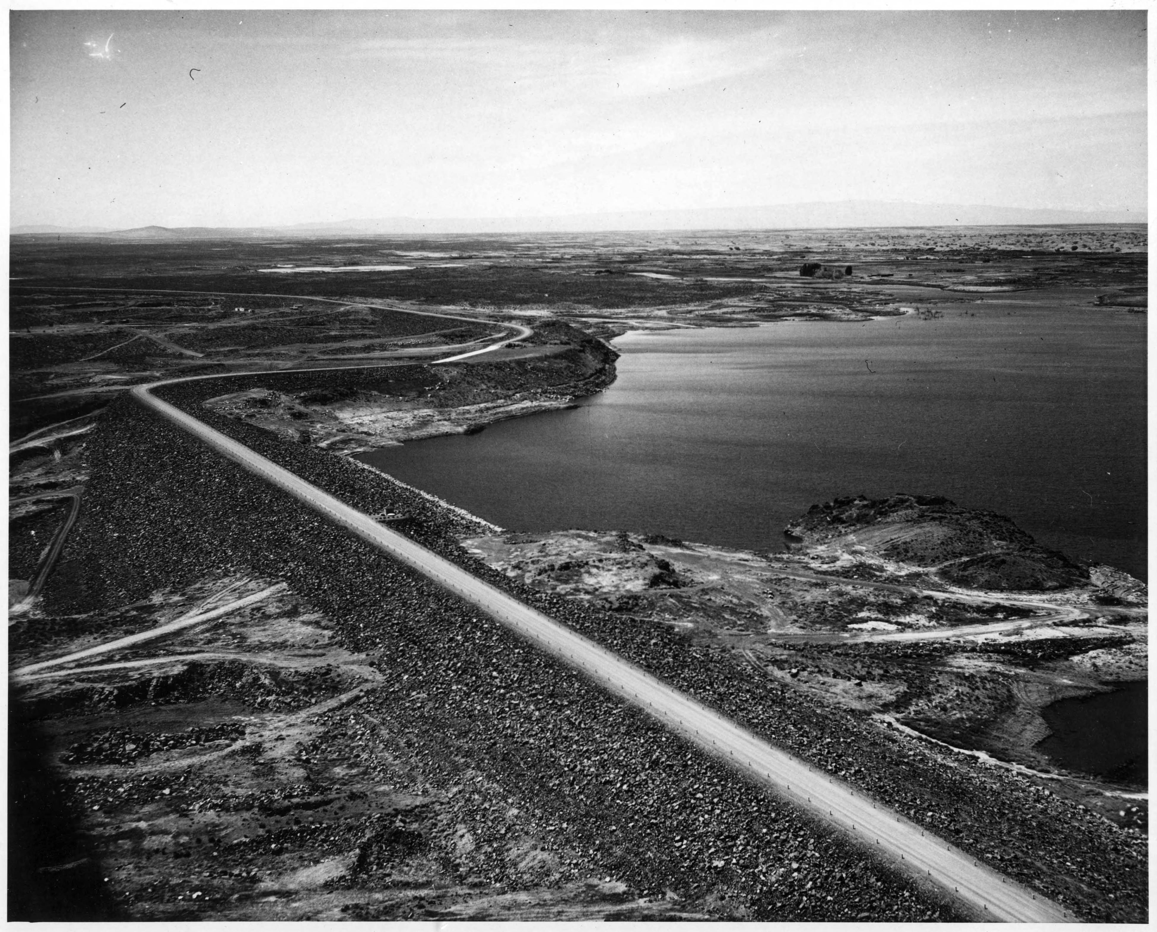
- Aerial View Of O'Sullivan Dam
- Creator:
- Foss, H.E.
- Date Created (ISO Standard):
- 1950-05-31
- Description:
- Columbia Basin Project, Irrigation Division, O'Sullivan Dam. Aerial view looking west, shows dam between stations 60+00 at extreme left and station 196+00 at lower right. The area seen above the dam will be largely covered when the water behind the dam is operation level. H.E. Foss, photographer.
- Subjects:
- dams in Washington (state)
- Location:
- Washington (State);Grant County;O'Sullivan Dam
- Latitude:
- 46.981595
- Longitude:
- -119.255047
- Series:
- Series 12: Construction Methods and Long Lake Dam
- Publisher:
- University of Idaho Library Digital Initiatives, http://www.lib.uidaho.edu/digital/
- Source:
- Army Corps of Engineers Dam Construction photographs, 1933-1965, PG 94, University of Idaho Library Special Collections and Archives
- Finding Aid:
- https://archiveswest.orbiscascade.org/ark:80444/xv165618
- Source Identifier:
- 94-4-3887
- Type:
- Image;StillImage
- Format:
- image/jpeg
- Language:
- eng
U of I Digital Collections contain unique digitized and born digital archival materials in a variety of formats. The Library is committed to ensuring our resources are accessible to all users. Please contact us if you need support accessing or using this archived content.
Contact us about this record Library HelpAttribution
- Citation:
- "Aerial View Of O'Sullivan Dam", Columbia River Basin Project: Dam Construction in the Pacific Northwest, University of Idaho Library Digital Collections, https://www.lib.uidaho.edu/digital/crbp/items/crbp909.html
Rights
- Rights:
- In copyright, educational use permitted. Educational use includes non-commercial reproduction of text and images in materials for teaching and research purposes. For other contexts beyond fair use, including digital reproduction, please contact the University of Idaho Library Special Collections and Archives Department at libspec@uidaho.edu. The University of Idaho Library is not liable for any violations of the law by users.
- Standardized Rights:
- http://rightsstatements.org/vocab/InC-EDU/1.0/