
IMAGE
Numbered Rocks Item Info
- Title:
- Numbered Rocks
- Creator:
- Fuller, H.W.
- Date Created (ISO Standard):
- 1948-03-05
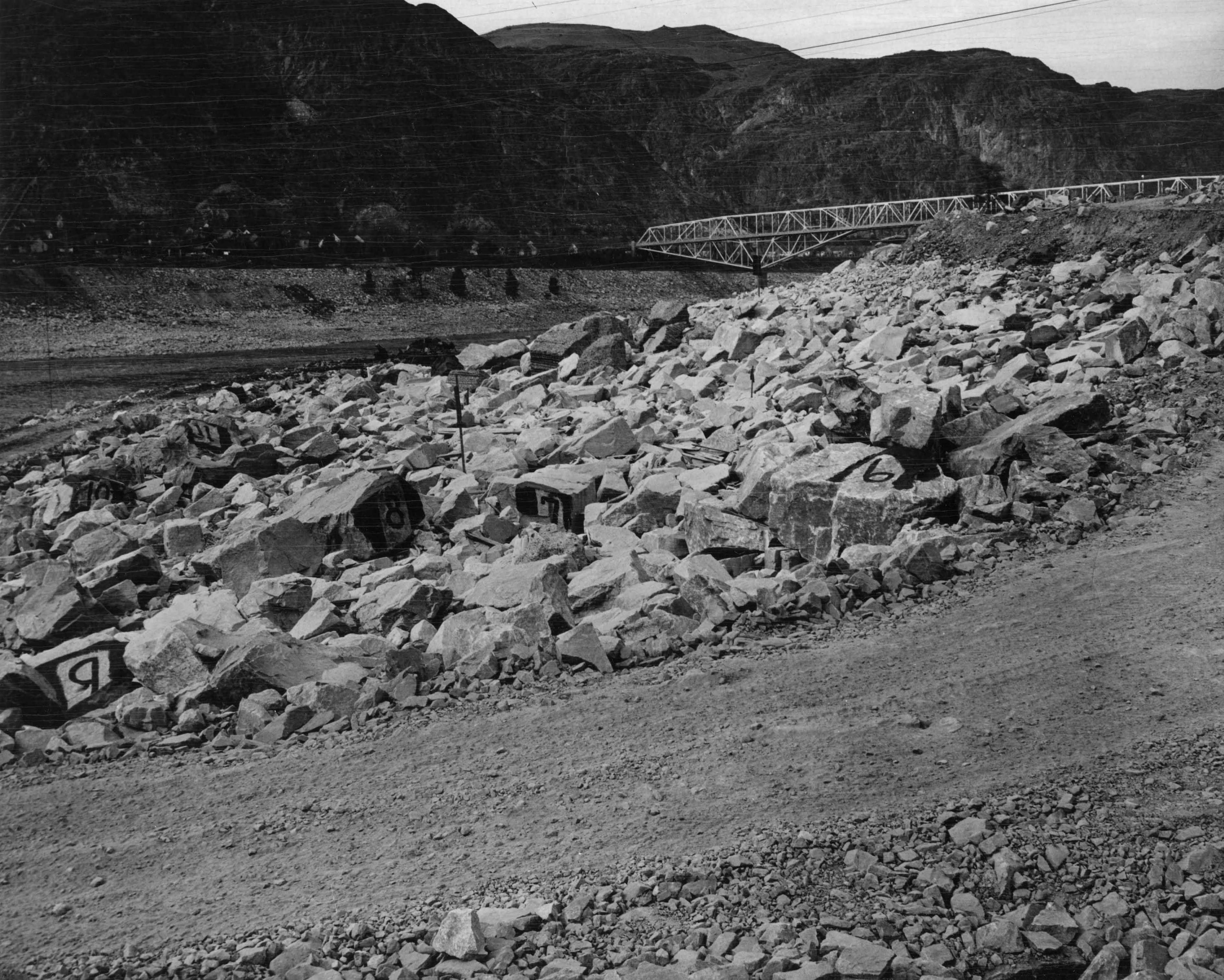
- Description:
- View towards northwest from deflection sheave #5, showing large rocks on riprap with their identifying numbers painted on them. A similar photo taken after 1948 high-waster will show to what extent the large rocks are moved by the high water. See book #143, page #39, for location of rocks.
- Subjects:
- canals (Washington state)
- Location:
- Washington (State)
- Latitude:
- 47.963303
- Longitude:
- -118.975453
- Series:
- Series 10: Riverbank Slope Protection and Floating Caisson for Repairing Spillway Bucket
- Publisher:
- University of Idaho Library Digital Initiatives, http://www.lib.uidaho.edu/digital/
- Source:
- Army Corps of Engineers Dam Construction photographs, 1933-1965, PG 94, University of Idaho Library Special Collections and Archives
- Finding Aid:
- https://archiveswest.orbiscascade.org/ark:80444/xv165618
- Source Identifier:
- 94-3-16833
- Type:
- Image;StillImage
- Format:
- image/jpeg
- Language:
- eng
U of I Digital Collections contain unique digitized and born digital archival materials in a variety of formats. The Library is committed to ensuring our resources are accessible to all users. Please contact us if you need support accessing or using this archived content.
Contact us about this record Library HelpAttribution
- Citation:
- "Numbered Rocks", Columbia River Basin Project: Dam Construction in the Pacific Northwest, University of Idaho Library Digital Collections, https://www.lib.uidaho.edu/digital/crbp/items/crbp939.html
Rights
- Rights:
- In copyright, educational use permitted. Educational use includes non-commercial reproduction of text and images in materials for teaching and research purposes. For other contexts beyond fair use, including digital reproduction, please contact the University of Idaho Library Special Collections and Archives Department at libspec@uidaho.edu. The University of Idaho Library is not liable for any violations of the law by users.
- Standardized Rights:
- http://rightsstatements.org/vocab/InC-EDU/1.0/