
IMAGE
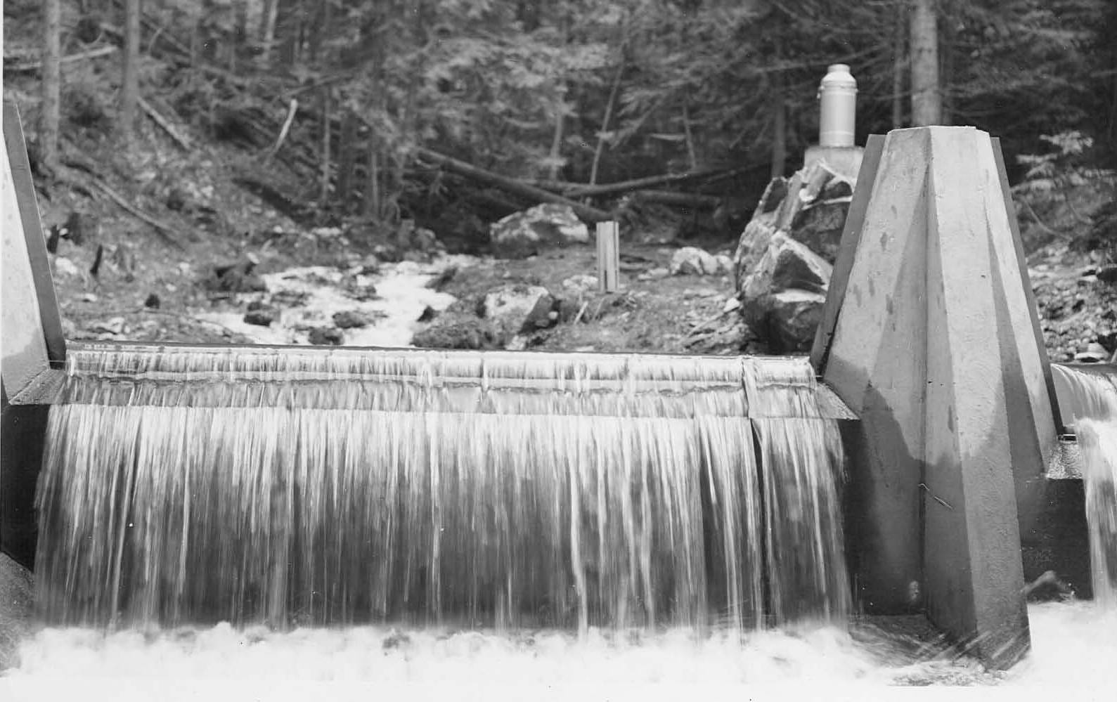
Benton Creek gaging dam during spring runoff Item Info
- Title:
- Benton Creek gaging dam during spring runoff
- Photographer:
- McKeever, D.G.
- Date Created (ISO Standard):
- 1939
- Description:
- Back of photo reads: "Benton Creek gaging dam during spring runoff. Flow or discharge = 4.46 sec. ft. Depth of water over crest of weir #2 (to the right) = 0.883 ft. Depth of water over weir #1 (main weir in center of picture) = 0.133 ft. April 15, 1940 DGM 40-17"
- Location:
- Bonner County, Idaho
- Idaho County:
- Bonner County
- Features:
- Priest River Experimental Forest Benton Dam
- Latitude:
- 48.35027778
- Longitude:
- -116.8
- Moscow Number:
- 605
- Source:
- The sources for the photos in this collection were as follows: Priest River Experimental Forest, Moscow Foresty Sciences Lab, USDA-Forest Service Region 1 archive, University of Montana Library Gisborne Collection, and Ms. Susan Marsh
- Source Identifier:
- BD_BS_PptRunoff1941_P9
- Type:
- Image;StillImage
- Format:
- image/jpeg
U of I Digital Collections contain unique digitized and born digital archival materials in a variety of formats. The Library is committed to ensuring our resources are accessible to all users. Please contact us if you need support accessing or using this archived content.
Contact us about this record Library HelpAttribution
- Citation:
- "Benton Creek gaging dam during spring runoff", Experimental Forest and Savenac Nursery Archive, University of Idaho Library Digital Collections, https://www.lib.uidaho.edu/digital/expforest/items/expforsav92.html
Rights
- Rights:
- Material produced by the United States Forest Service and is in Public Domain. For more information, please contact University of Idaho Library Special Collections and Archives Department at libspec@uidaho.edu.
- Standardized Rights:
- https://creativecommons.org/publicdomain/mark/1.0/