
IMAGE
Map of Military Road from Fort Walla Walla on the Columbia to Fort Benton on the Missouri Item Info
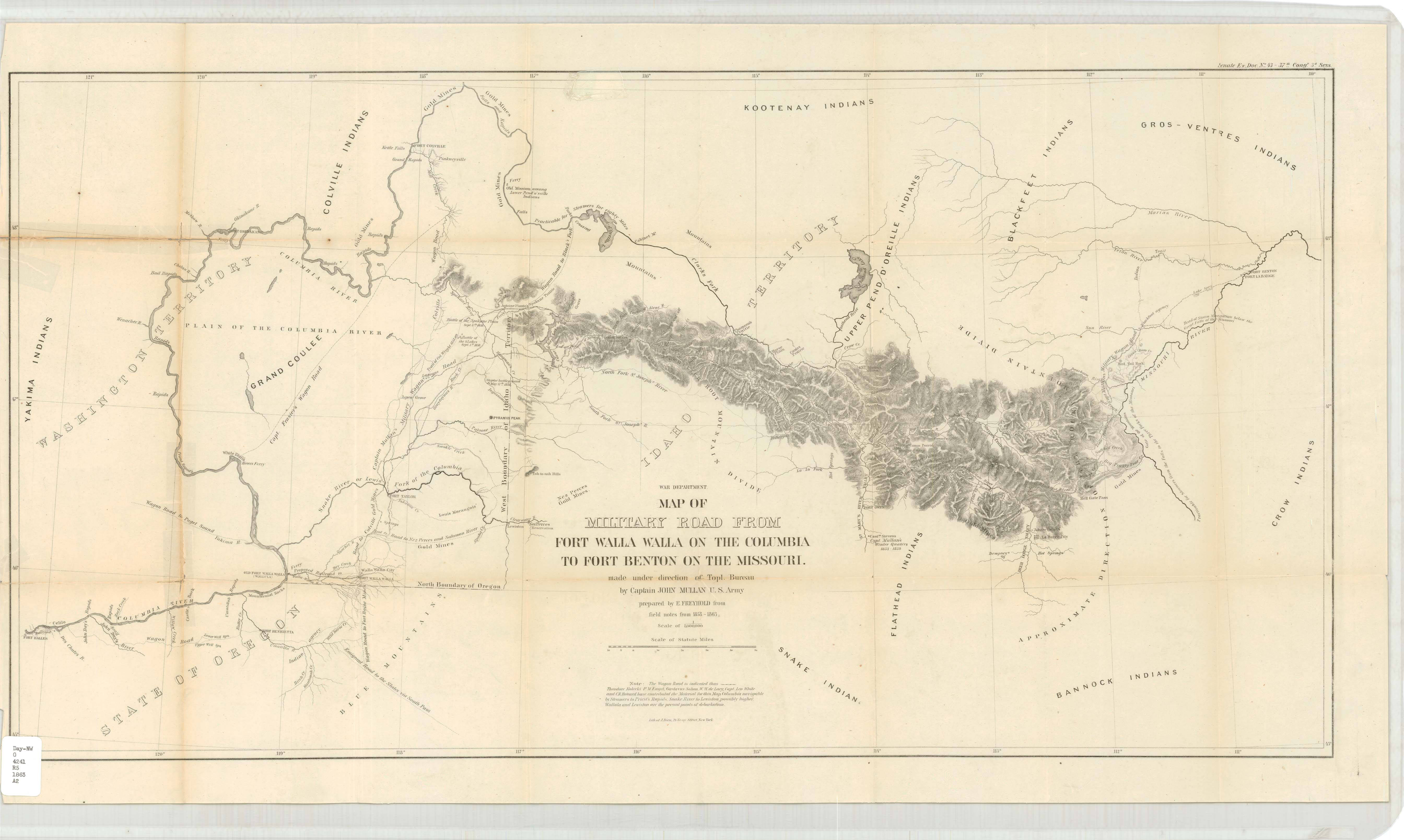
- Title:
- Map of Military Road from Fort Walla Walla on the Columbia to Fort Benton on the Missouri
- Date Created (ISO Standard):
- 1863
- Description:
- Made under direction of Topl. Bureau by Captain John Mullan, U.S. Army. War Department. Scale: 1:1,013,760. 1 in. to 16 miles. Washington, D.C.
- Coverage:
- Idaho Washington (State) Oregon Montana
- ArcGIS georectified digital map:
- https://uidaho.maps.arcgis.com/home/item.html?id=8bbe6494be6d4bc3924a160c86c2d699
- Source:
- University of Idaho Library Special Collections and Archives, http://www.lib.uidaho.edu/special-collections/
- Source Identifier:
- militaryroad_1863
- Type:
- Image;StillImage
- Format Original:
- 1 map; 51 x 90 cm.
- Format:
- image/jpeg
- Language:
- eng
U of I Digital Collections contain unique digitized and born digital archival materials in a variety of formats. The Library is committed to ensuring our resources are accessible to all users. Please contact us if you need support accessing or using this archived content.
Contact us about this record Library HelpAttribution
- Citation:
- "Map of Military Road from Fort Walla Walla on the Columbia to Fort Benton on the Missouri", Idaho Historical Maps Collection, University of Idaho Library Digital Collections, https://www.lib.uidaho.edu/digital/historicalmaps/items/spec_hm4.html
Rights
- Rights:
- Material determined to be in Public Domain based on date of publication. Material made available by the University of Idaho Library. For more information, please contact University of Idaho Library Special Collections and Archives Department at libspec@uidaho.edu.
- Standardized Rights:
- https://creativecommons.org/publicdomain/mark/1.0/