
PDF
Hand drawn map of Princeton, ID Item Info
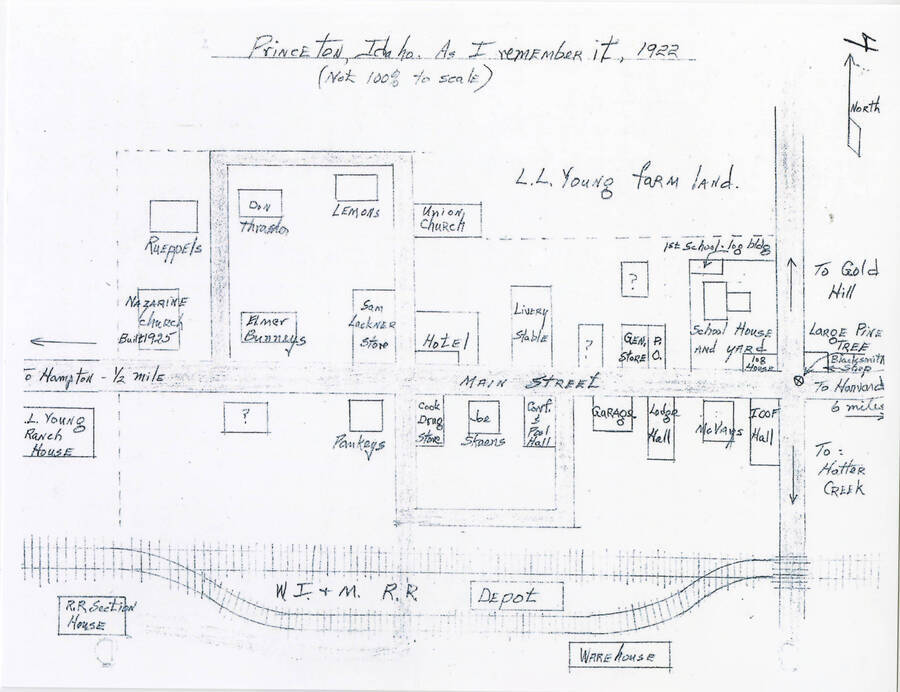
- Title:
- Hand drawn map of Princeton, ID
- Date Created (ISO Standard):
- 1922
- Description:
- Hand drawn map of Princeton, ID with descriptions and locations
- Contributors:
- G. Strong
- Subjects:
- maps buildings (structures) towns streets businesses
- Country:
- United States
- State:
- Idaho
- County:
- Latah County
- Idaho County:
- Latah County
- City:
- Princeton
- Location:
- Princeton, Idaho
- Latitude:
- 46.913691
- Longitude:
- -116.837863
- Source Identifier:
- CH2018_StrongG1_017
- Type:
- Image;StillImage
- Original Format:
- document
- Format:
- application/pdf
U of I Digital Collections contain unique digitized and born digital archival materials in a variety of formats. The Library is committed to ensuring our resources are accessible to all users. Please contact us if you need support accessing or using this archived content.
Contact us about this record Library HelpAttribution
- Citation:
- "Hand drawn map of Princeton, ID", Latah County Community Heritage Collection, University of Idaho Library Digital Collections, https://www.lib.uidaho.edu/digital/lcheritage/items/lcheritage695.html
Rights
- Rights:
- No Copyright - United States. Digital reproduction rights assigned to the University of Idaho Library by donor. For more information, please contact University of Idaho Library Special Collections and Archives Department at libspec@uidaho.edu.
- Standardized Rights:
- http://rightsstatements.org/vocab/NoC-US/1.0/