
Episode 37 : Shards of the Past Item Info
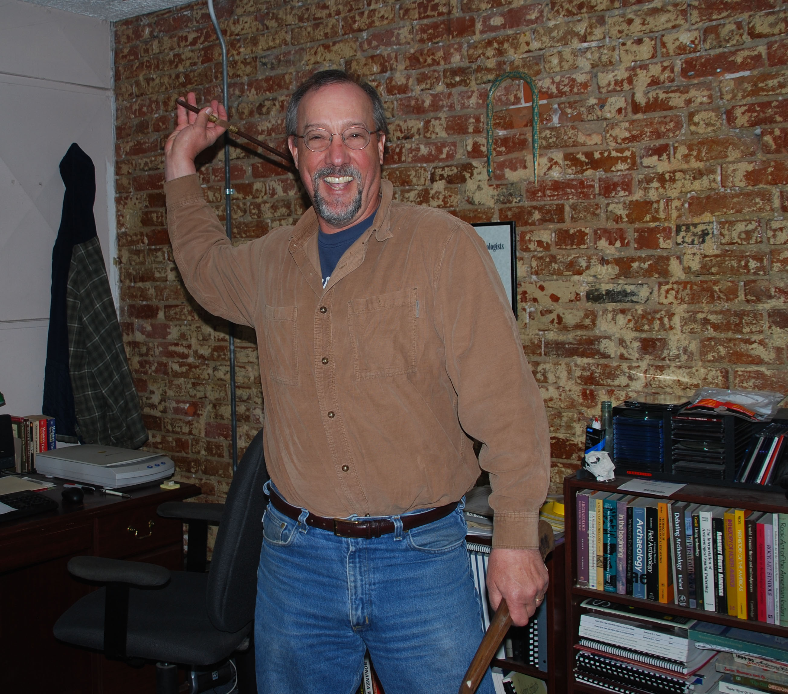
In this episode, titled “Shards of the Past,” Matt Root talks about archaeology in the Selway-Bitterroot Wilderness. Since 2000, Matt has owned Rain Shadow Research, whose projects have included working with the Ni’mi-poo tribe to locate the sites of former villages or sacred gathering locations.
Matt Root earned a Bachelor’s and Master’s degree in anthropology and archaeology from the University of Kansas, and a Doctorate in anthropology and archaeology from Washington State University. He has worked in archaeological research for thirty-six years, with the past thirteen years focused on Idaho and Washington. His company reports on archaeological sites for dam relicensing, or for Idaho Power to determine the locations of important sites for preservation or excavation.
Here, Matt tells about the process of locating an important site within the boundaries of the Selway-Bitterroot Wilderness, and what it means to wilderness users today.
Audio Clip
Interviewer: Debbie Lee
Interviewee: Matt Root
Location: Pullman, Washington
Date: May 7, 2011
DL: So how would you describe the early peoples that lived in sort of north central Idaho and you said the Frank Church River of No Return. You've done work in the Selway-Bitterroot and then Hells Canyon. Is it just a myriad of different peoples or is there kind of a unifying characteristic or?
MR: Well, the earliest occupations that we've investigated in the area are what we call Clovis and these are people with large spear points, fluted. They hunted mammoth, extinct forms of bison. I've excavated the Wenatchee, East Wenatchee Clovis site where there were large Clovis points about 18-19 cm long with carved mammoth bone placed in probably a ceremonial offering. Ken Reid and I just published a small paper on a Clovis point from Hells Canyon and that provides evidence for the earliest occupation of Hells Canyon. And in calendar years that's about 13,000, 13,500 years ago. There are probably earlier occupations out there. There are slightly earlier occupations known in Oregon and elsewhere in North America but those are the earliest people in Washington, North Idaho.
DL: Okay, wow. So you went back and did some digs in the upper Selway in the Selway-Bitterroot Wilderness. Can you just talk about what it was that you were supposed to do there and maybe some of the things that you found.
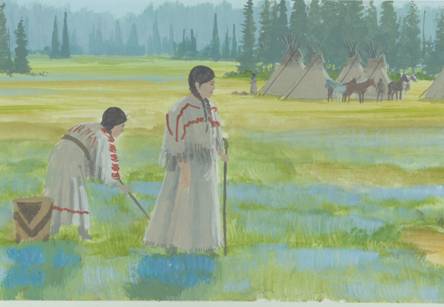
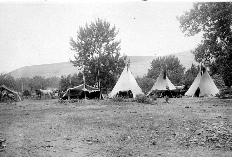
MR: There is a site that is at the confluence of [Name Withheld]* Creek and the Selway River. When the Selway River has high flows in the springtime with spring rains and snow melt the river flows against the bank and erodes, the sediment erodes the river terrace. Now there's an archeological site in that river terrace and every time the river erodes that cutbank and takes sediment away it leaves artifacts strewn on the beach and I think it was 1995 Forest Service archeologists were essentially doing an inventory, looking for archeological sites along the river, and they found this site. As it turns out this is a place where a Nez Perce elder whose English name is Billy Williams, Billy William, I'm sorry. He was interviewed by Alice Fletcher who was an ethnographer from Washington, D.C., and in the 1880s she had Billy William draw a map of North Idaho, Washington, actually more North Idaho even down into the Snake River Plain where he drew all the rivers, the major rivers, the Columbia, the Snake, the Clearwater and hundreds of their tributaries and he placed 76, I believe, Nez Perce villages that were occupied in the 1700-1800s and gave most of them their Nez Perce name. At the place on his map where through comparing with modern maps we've determined to be at the confluence of [Name Withheld] Creek and the Selway River he placed a dot and he called that village Ne'hu-lat-pu and this was part of the Sal-wah'-poo Village group on what historically was known as the upper Clearwater but now what we call the Selway River and the Sal-wah'-poo means people of the Sal-wah so Ne'hu-lat-pu is one of the older villages within the Sal-wah'-poo and Billy William mentioned that this village group was the oldest village group amongst the Nez Perce. This is where the long ago Nez Perce lived. And where he placed that dot on his map in the 1880s is where this archeological site was found in 1995 and we're fairly confident that this is the village of Ne'hu-lat-pu. There are what we call house pits, circular depressions in the river terrace that mark the place, mark the places of Nez Perce pit houses. These will be houses that had their foundations dug several feet own into the ground and then mats, grass mats would be erected on a pole framework and this was the traditional winter village type of Nez Perce and other people on the plateau.
DL: So you date those impressions to approximately what year?
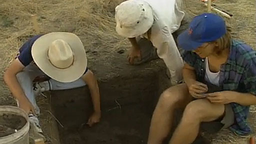
MR: The radiocarbon dates we have that we think are associated with those house pits run from about A.D. 1300 into the 1600s. And now our excavations are only along the river bank. We were tasked by the Forest Service to find out what kind of artifacts were being threatened, that were eroding and being threatened with further erosion, how old they might be, how deep they were. And so we did not do any excavations within these house pits themselves because they are a few meters back away from the edge and our excavations were just along the cut bank. The idea is that we wanted to disturb as little of the site as possible and the Nez Perce have concerns about the site and it's a culturally sensitive site and we did not want to dig in any of the house pits because they're not immediately threatened by destruction and the Nez Perce would just as soon that we not dig in their ancestral house pits unless it's absolutely necessary. But, so, but we think that those later dates from the 1300s on to the 1600s and possibly into the 1700s would date those house pits and that's concordant with what Billy William had also mentioned. He said that it was abandoned just before Lewis and Clark stumbled out of the Bitterroot Mountain cold and hungry and were taken in by the Nez Perce.
DL: So, but then there's also evidence of much older occupation, right?
MR: There are artifacts that we have found in excavations below the levels that we've dated to A.D. 1300 but there's few artifacts. We don't have anything that we can get a radiocarbon date from so far. We've only found one small dart point in those lower levels and that may only be a few thousand years old. We have found other artifact types on the beach below the cut bank that may be as much as 6,000 years old. They're certainly probably at least about 4,500 years old. They're large side notched dart points.
DL: So do you know if these communities were occupied just during the summer months or did people overwinter there?
MR: Actually the pattern ethnographically is where the people overwintered. Now, archeologically we don't have any evidence of what season that they occupied these villages but traditionally people would have been in the mat villages during the winter. In the springtime when the snow would thaw people would start at the lower elevations collecting edible plants, roots, and they would and then when the fish runs would begin in spring, on the Clearwater those were a little bit later, but as soon as the fish would start to run in this area in the Clearwater. People might move down out of the Selway River to the Clearwater to lower elevations to gather spring, the spring crops and fish when they came in May and then people would essentially move upward in elevation as spring progresses upward through the mountains and so people were away from their villages fishing, hunting, gathering foods as they became available at the different elevations throughout the spring, summer, and then into the fall with the fall fish runs and fall hunts. And then after the fall fish runs and fall hunts and gathering berries in the fall people would move back to the aggregated villages along the major streams like the Selway, Clearwater, Snake, Columbia where they would live off stored foods.
DL: Yah. It just, maybe I'm mistaken, but the upper Selway seems like a pretty harsh environment to live year around. Is that, that doesn't strike you as being odd because it would seem like a lower elevation site might be. It says something about the people who stayed there over winter about how they can endure those pretty harsh winter conditions.
MR: Right, and the modern environmental and weather data that we have for this area shows that this little area on the confluence of [Name Withheld]* Creek is really a little bit warmer than it is on the lower, farther down on the Clearwater. And if you move much farther up on the Selway it gets considerably colder. It's also in a slight rain shadow and so it's a little bit drier and it's a little bit warmer than other places. But, you're right, it is a relatively high elevation for a winter village but people were there. And, of course, the other thing to remember is that it was abandoned probably in the 1700s and remember Billy William had drawn in 70 some Nez Perce villages and, of course, when Lewis and Clark came through there were not over 70 Nez Perce villages left. You know, people were ravaged by diseases. There were diseases, epidemic diseases came through the area almost every generation, you know. We know there was a large epidemic in 1780 and there was probably epidemics before that. We know there were epidemics on the upper Missouri before any French fur trappers ever came to trade, to trade with the Mandan.
*Identifying Location names withheld. For information on the precise location of historical sacred sites, please contact the Nez Perce tribe.
Gallery
- Title:
- Episode 37 : Shards of the Past
- Date Created (ISO Standard):
- 2013-06-04
- Description:
- In this episode, titled "Shards of the Past," Matt Root talks about archaeology in the Selway-Bitterroot Wilderness. Since 2000, Matt has owned Rain Shadow Research, whose projects have included working with the Ni'mi-poo tribe to locate the sites of former villages or sacred gathering locations. Matt Root earned a Bachelor's and Master's degree in anthropology and archaeology from the University of Kansas, and a Doctorate in anthropology and archaeology from Washington State University. He has worked in archaeological research for thirty-six years, with the past thirteen years focused on Idaho and Washington. His company reports on archaeological sites for dam relicensing, or for Idaho Power to determine the locations of important sites for preservation or excavation. Here, Matt tells about the process of locating an important site within the boundaries of the Selway-Bitterroot Wilderness, and what it means to wilderness users today.
- Duration:
- 13:34
- Subjects:
- archaeology nimiipuu tribe
- Section:
- Wilderness Voices
- Location:
- Selway-Bitterroot Wilderness (Idaho and Mont.)
- Publisher:
- Wilderness Voices, The Selway-Bitteroot Wilderness History Project, https://selwaybitterrootproject.wordpress.com/
- Source:
- Wilderness Voices, The Selway-Bitteroot Wilderness History Project, https://selwaybitterrootproject.wordpress.com/
- Original URL:
- https://selwaybitterrootproject.wordpress.com/2013/06/04/shards-of-the-past/
- Source Identifier:
- Selway-Podcast-ep37
- Original Format:
- Podcast
- Type:
- Sound
- Format:
- audio/mp3
- Language:
- eng
U of I Digital Collections contain unique digitized and born digital archival materials in a variety of formats. The Library is committed to ensuring our resources are accessible to all users. Please contact us if you need support accessing or using this archived content.
Contact us about this record Library Help- Citation:
- "Episode 37 : Shards of the Past", The Selway-Bitterroot Wilderness History Project, University of Idaho Library Digital Collections, https://www.lib.uidaho.edu/digital/sbw/items/sbw326.html
- Rights:
- Copyright: The Selway-Bitteroot Wilderness History Project. In Copyright - Educational Use Permitted. For more information, please contact University of Idaho Library Special Collections and Archives Department at libspec@uidaho.edu.
- Standardized Rights:
- http://rightsstatements.org/vocab/InC-EDU/1.0/