
IMAGE
Map of proposed campuses buildings. [4-3] Item Info
- Title:
- Map of proposed campuses buildings. [4-3]
- Date Created (ISO Standard):
- 1970
- Date is Approximate:
- y
- Description:
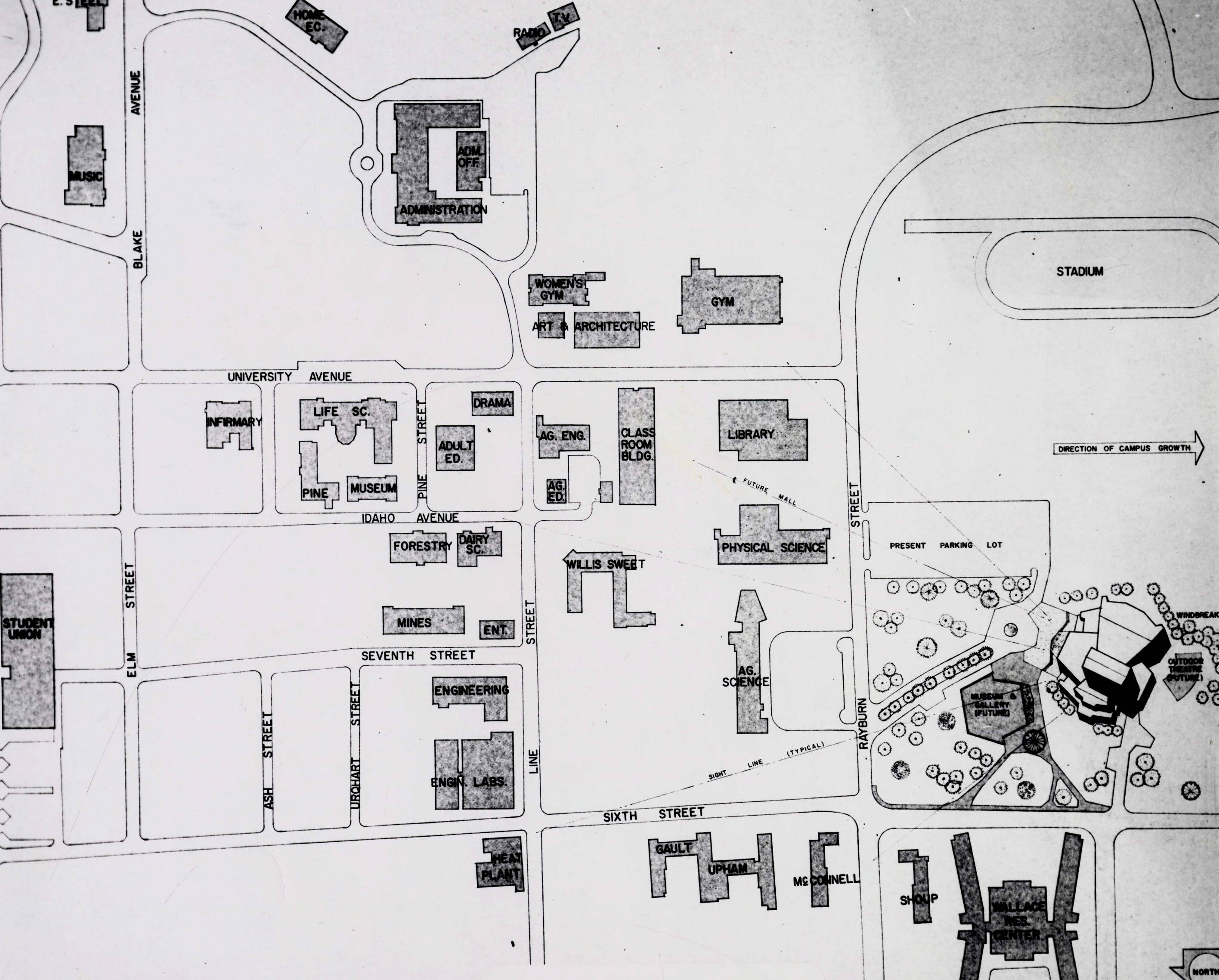
- 1970 photograph of University of Idaho campus. Campus depicted in a hand drawn map.
- Subjects:
- campuses buildings maps campus illustration, drawing or map
- Campus Location:
- University of Idaho Campus
- Latitude:
- 46.727849
- Longitude:
- -117.007289
- Source:
- University of Idaho Campus Photographs, PG 1, University of Idaho Library Special Collections and Archives
- Source Identifier:
- PG1_004-03
- Original Format:
- 8x10 black and white print of map
- Type:
- Image;StillImage
- Format:
- image/jpeg
U of I Digital Collections contain unique digitized and born digital archival materials in a variety of formats. The Library is committed to ensuring our resources are accessible to all users. Please contact us if you need support accessing or using this archived content.
Contact us about this record Library HelpAttribution
- Citation:
- "Map of proposed campuses buildings. [4-3]", Campus Photographs Collection, University of Idaho Library Digital Collections, https://www.lib.uidaho.edu/digital/campus/items/campus02022.html
Rights
- Rights:
- In copyright, educational use permitted. Educational use includes non-commercial reproduction of text and images in materials for teaching and research purposes. For other contexts beyond fair use, including digital reproduction, please contact the University of Idaho Library Special Collections and Archives Department at libspec@uidaho.edu. The University of Idaho Library is not liable for any violations of the law by users.
- Standardized Rights:
- http://rightsstatements.org/vocab/InC-EDU/1.0/