Jonathan Carver created this “new” map of North America in 1778 for Carvers Travels. It was published in London in 1781. Map courtesy of the Library of Congress.
View in MrSID format.


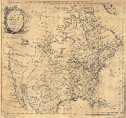 Jonathan Carver created this “new” map of North America in 1778 for Carvers Travels. It was published in London in 1781. Map courtesy of the Library of Congress.